
Town Center Community Improvement District Livable Centers Initiative
Overview.
Town Center, located in north central Cobb County, is home to more than 13,400 residents and experienced population growth between 2010 and 2020 at five times the rate of Cobb County as a whole. Anchored by Kennesaw State University (KSU), Fifth Third Stadium, and Cobb County International Airport, the district has evolved into one of the region's most significant employment and activity centers. Nearly 2,000 businesses support more than 35,000 primary jobs across the retail, hospitality, educational, office, industrial, and multifamily sectors, generating a multi-billion-dollar annual economic impact for both Cobb County and the State of Georgia.
As Town Center continues to grow, this LCI Plan (Plan) provides the strategic framework to coordinate public investment, guide future development, and translate a decade of planning into a clear implementation strategy.
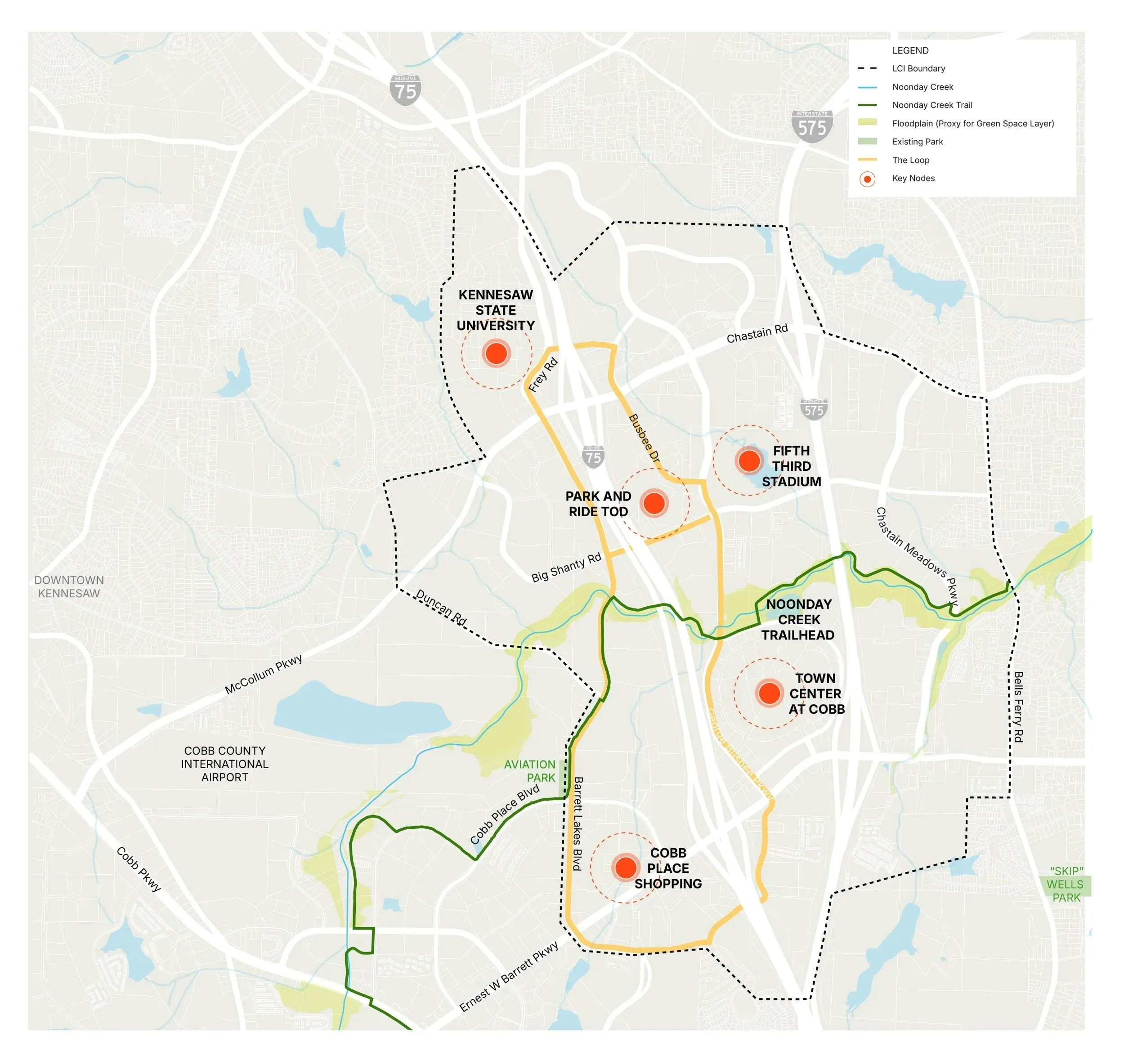
The Framework.
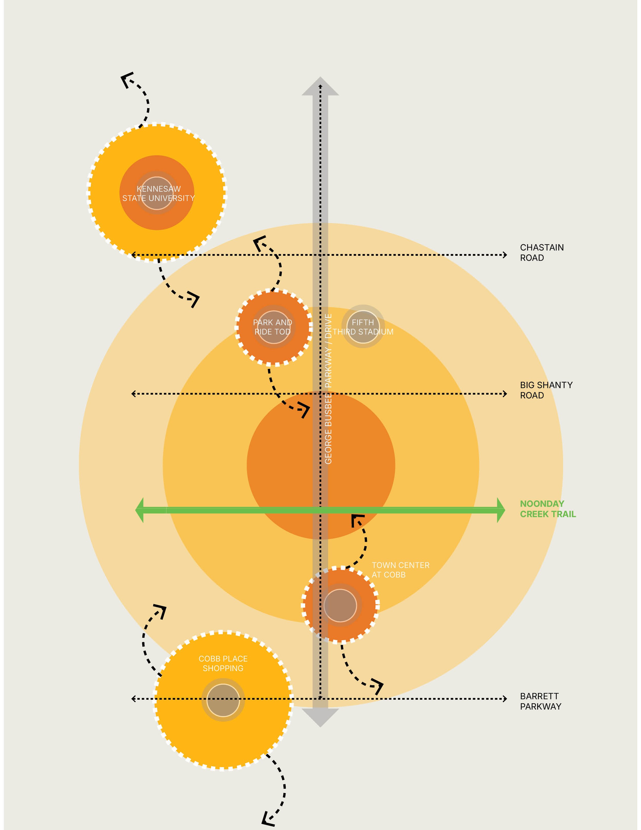
This Plan is organized around five Big Moves that define the overarching vision for the Town Center LCI Plan Update. These Big Moves emerged from a review of prior plans and existing conditions, followed by focused work sessions with Town Center Community Improvement District (TCCID) staff in July 2025 to evaluate priorities, refine strategies, and align projects and programs with the district's goals. Together, this process translated previous and ongoing planning efforts into a clear organizing framework, supported by complementary strategies and concepts detailed in the following sections.

-
![]()
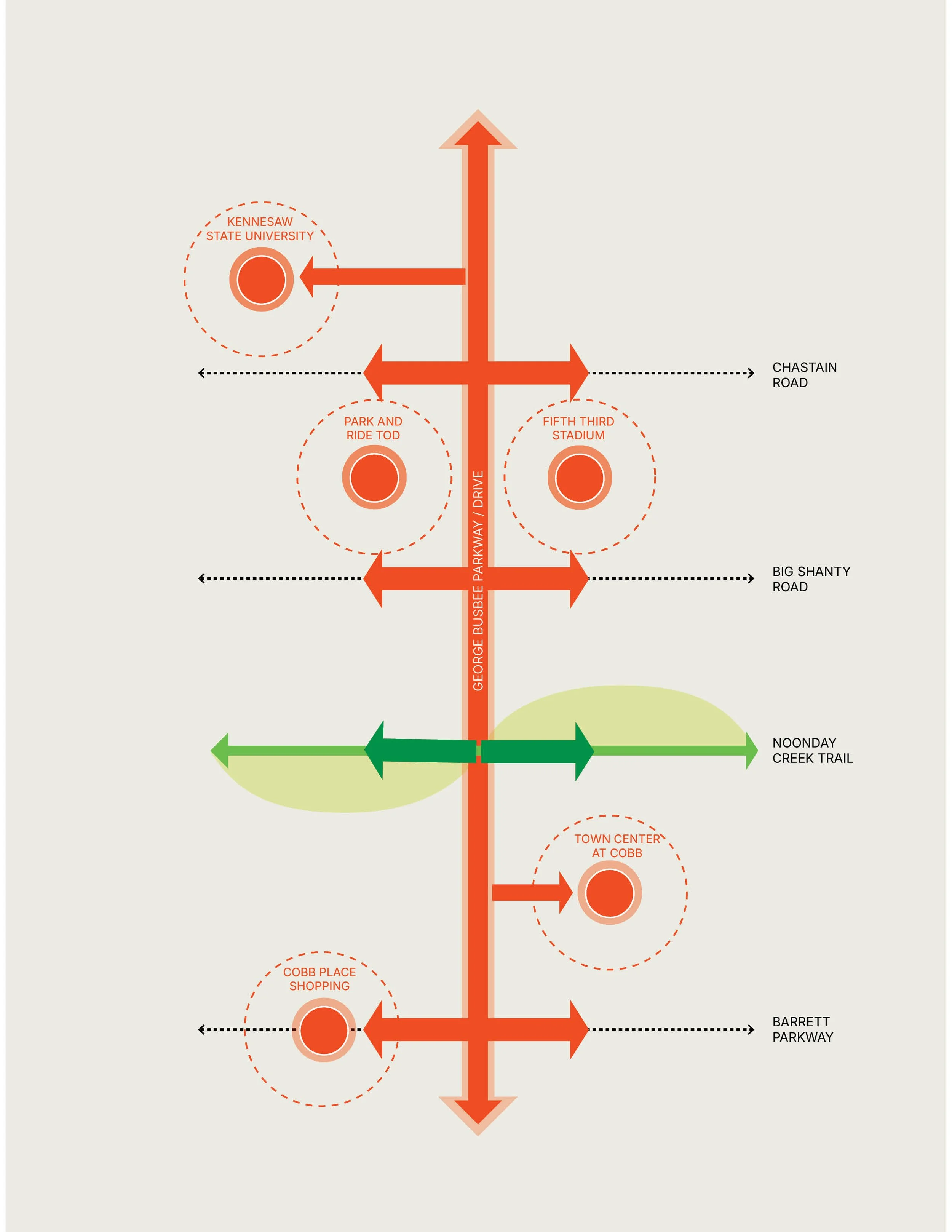
1. Build Your Spine
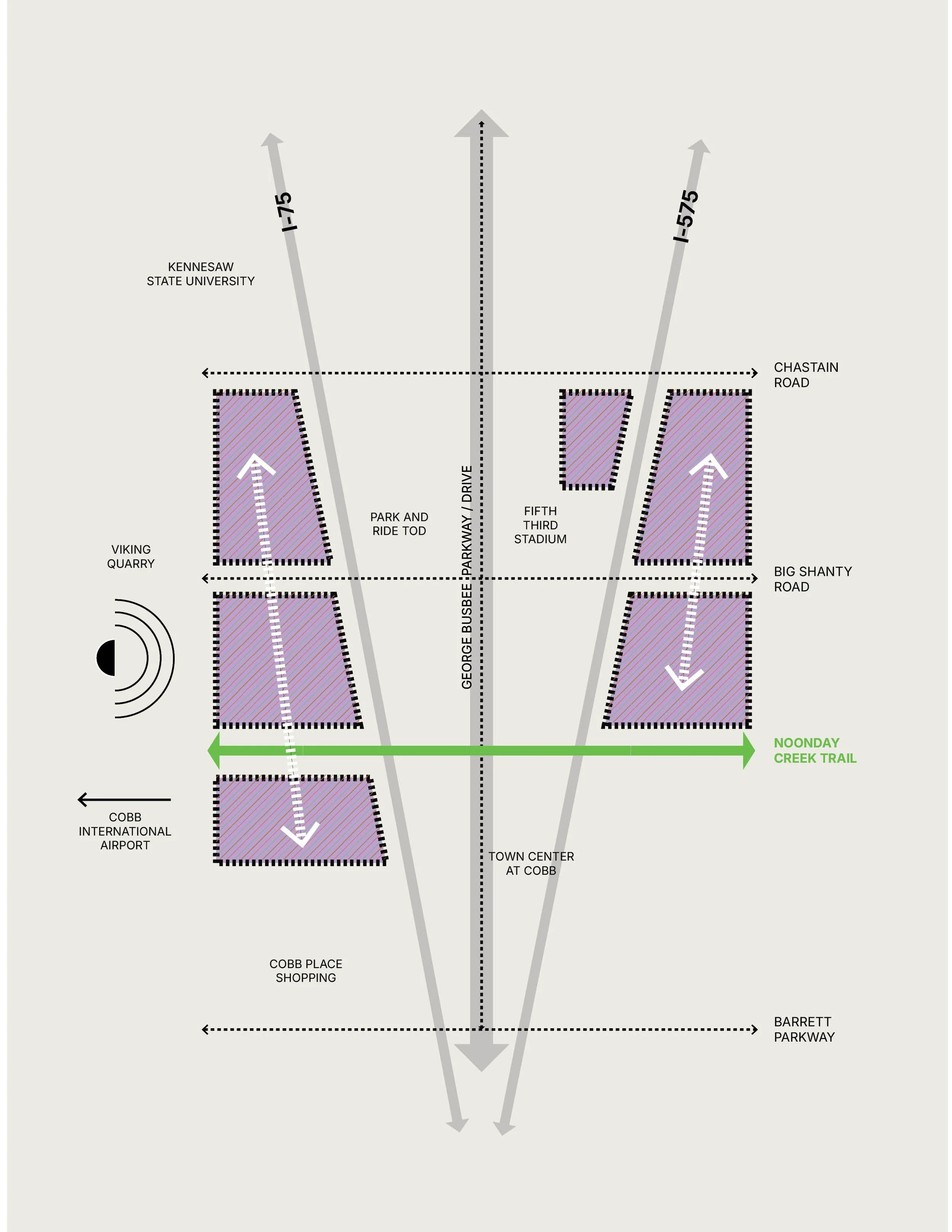
Establish a multimodal framework that enhances north-south connectivity by connecting east-west corridors with multimodal infrastructure to improve access to the district's nodes.
-
![]()
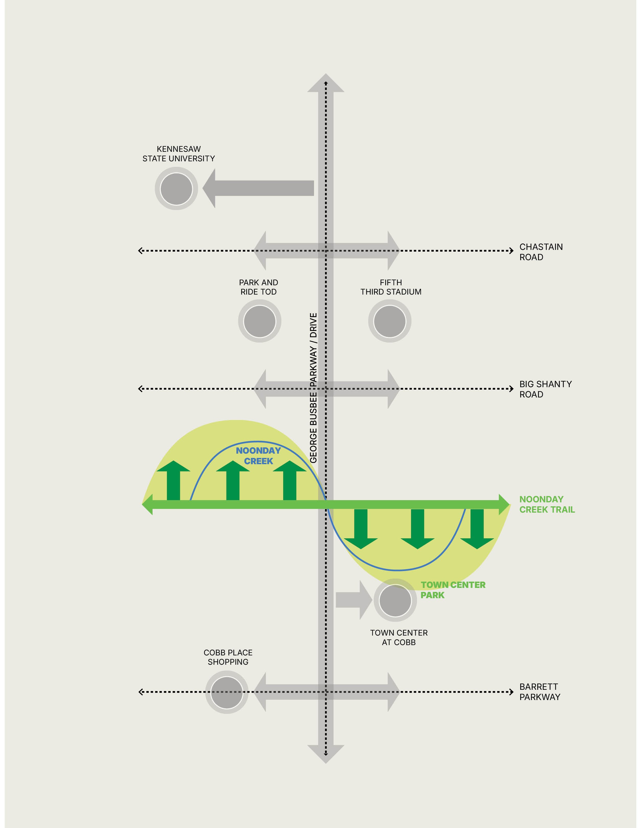
2. Expand Your Lungs
Capitalize on the success of the Noonday Creek Trail to expand access to open space and active transportation.
-
![]()
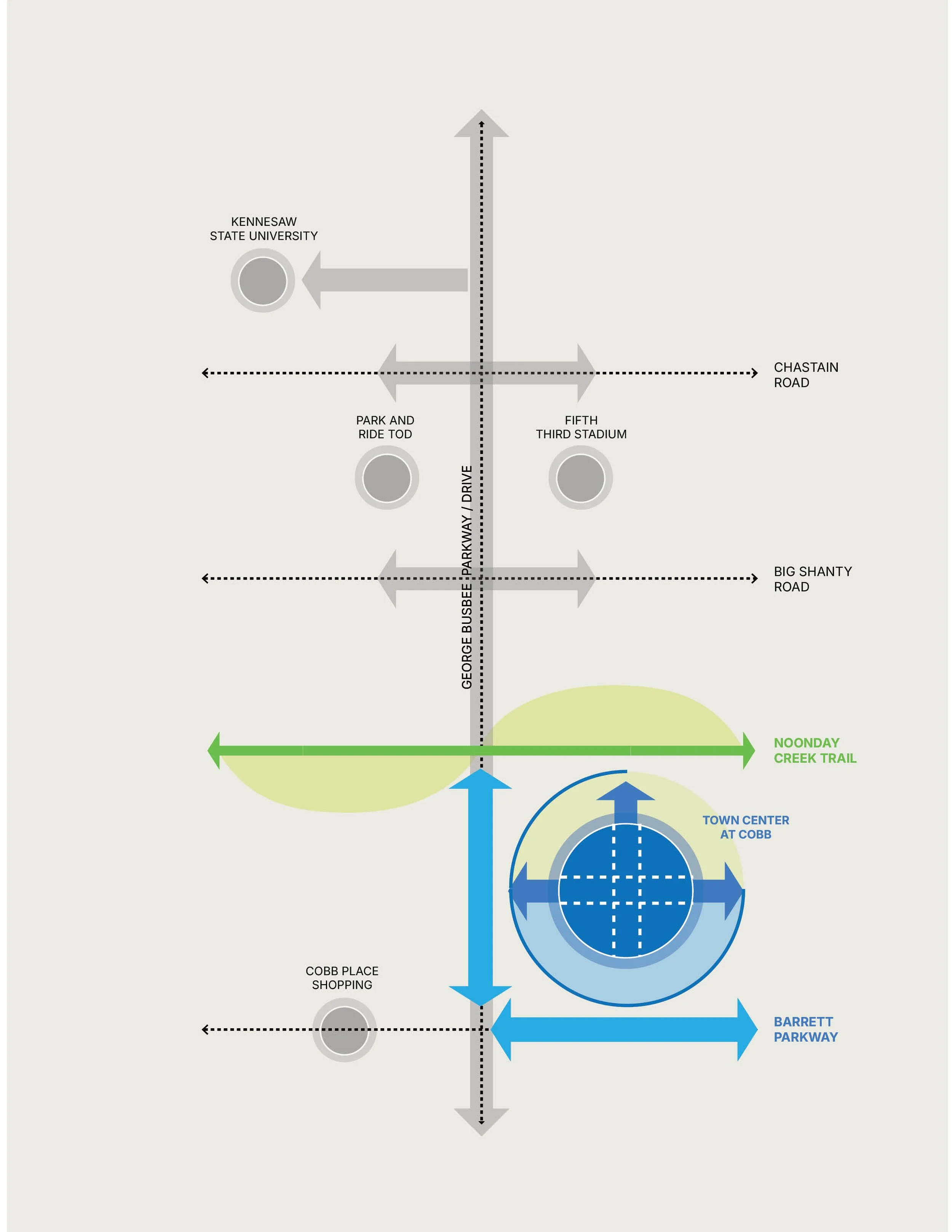
3. Strengthen Your Core
Strengthen the district's core to improve connectivity by exploring opportunities for new streets, connections, and activation of areas around the mall.
-
![]()
4. Flex Your Muscles
Position Town Center to respond to economic shifts by creating a framework for adaptive reuse of outdated commercial and industrial spaces, leveraging opportunities for innovation and entrepreneurship, and strengthening the area's brand within the region, by creating a signature regional attraction.
-
![]()
5. Support Your Housing
Recognize the importance of housing to the Town Center area and develop strategies that accommodate a variety of housing types while allowing the CID to continue to earn revenue needed to fund infrastructure and other improvements.
A Peek Into Some Strategies.
Strategy 1A: Establish Street Typologies.
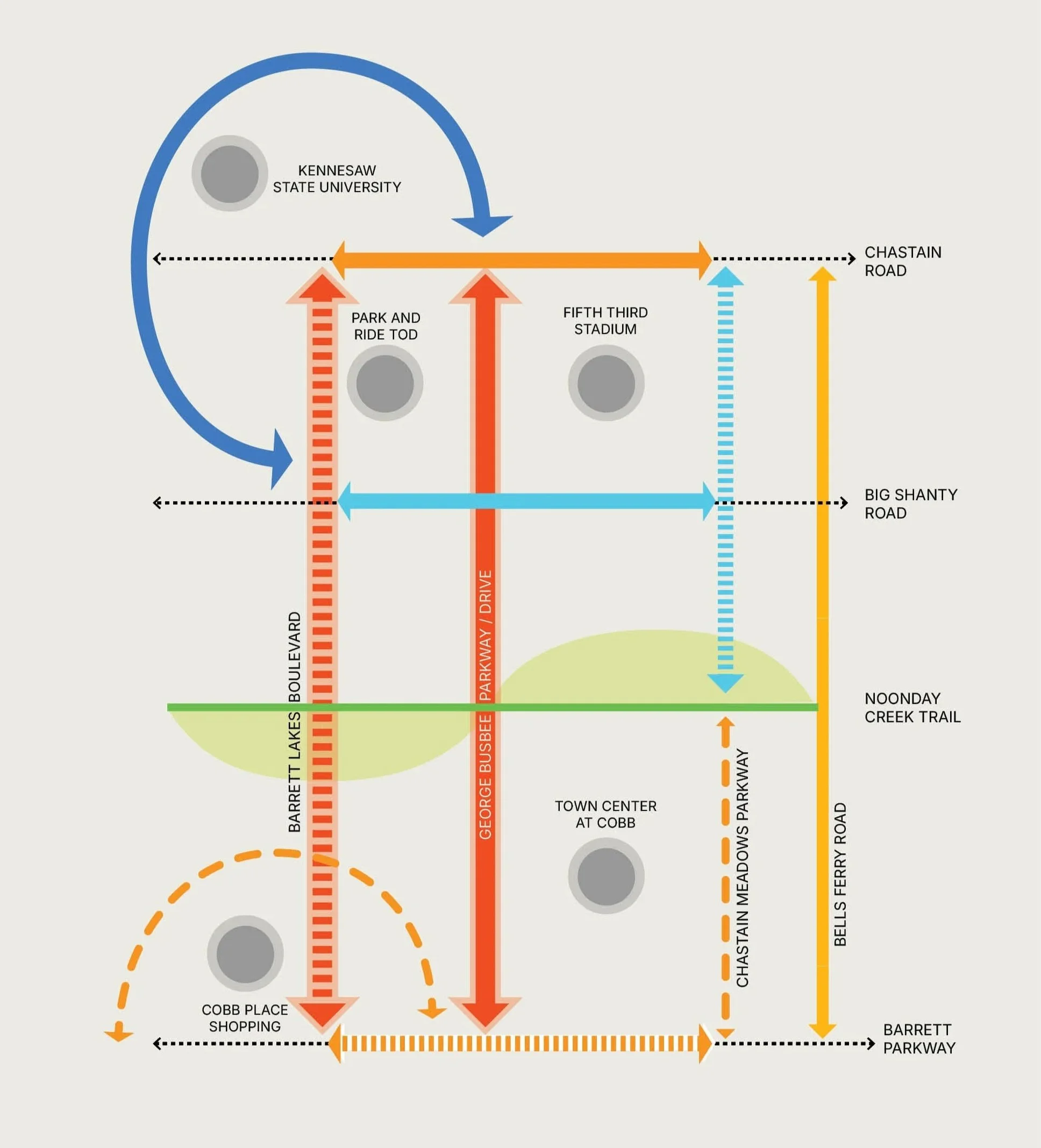
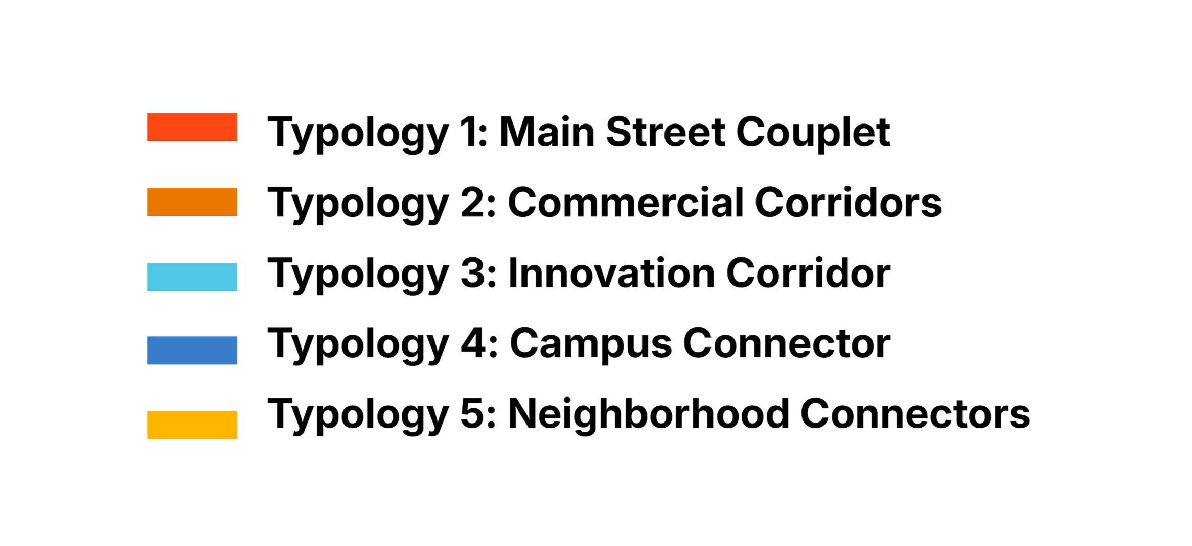
Street typologies form the basis of a master streets plan with design guidance to meet multimodal travel needs and target desired development types for each corridor. The primary roadways in the LCI area have been designated into one of five distinct typologies. These five typologies speak to design intent, while acknowledging momentum. They have been organized in a tier system to identify priority and level of intervention.
Typology 1: Main Street Couplet
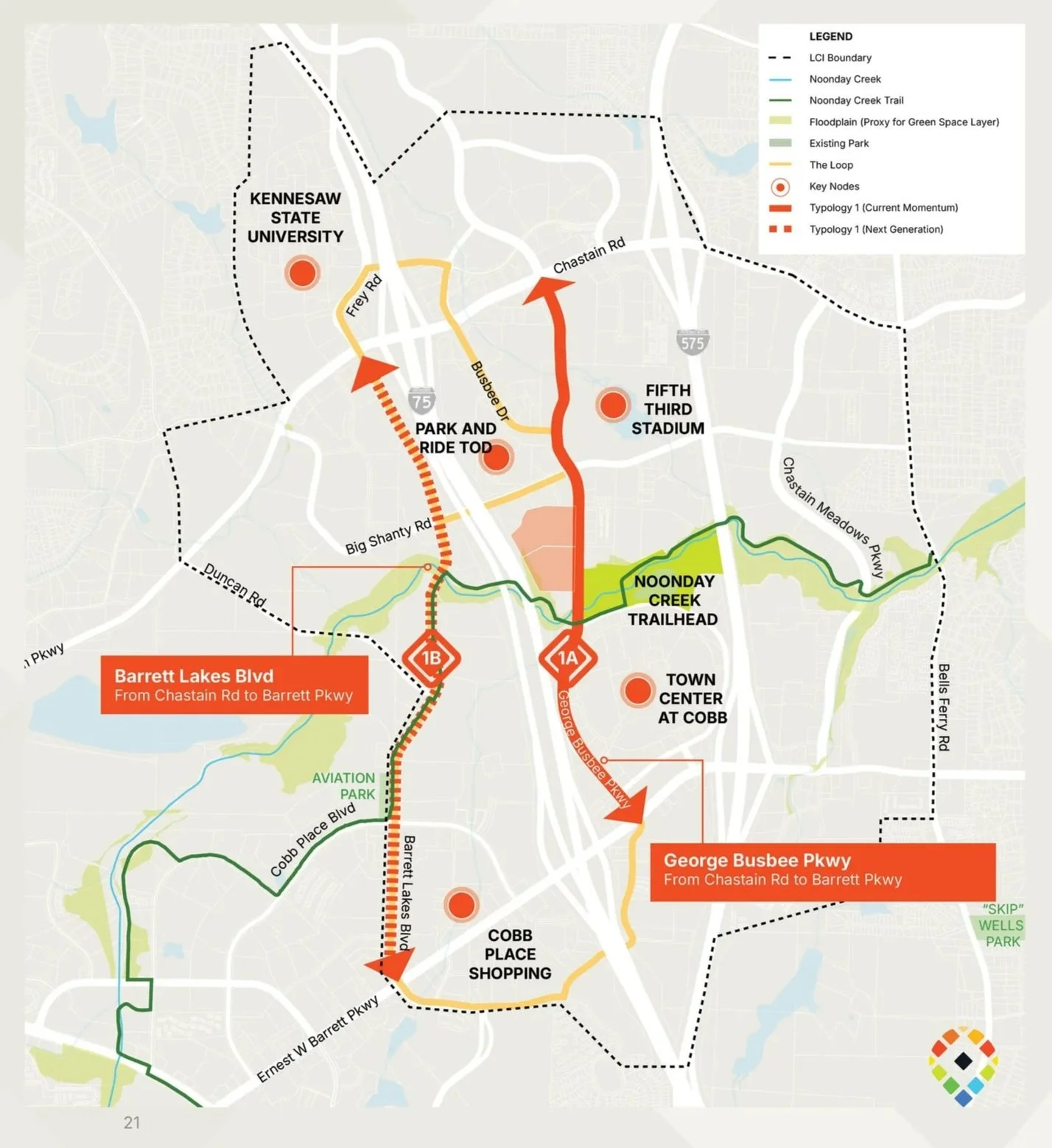
George Busbee Parkway currently serves as the district’s primary north-south connector. It links key destinations including KSU, the Chastain Road retail area, Fifth Third Stadium, the Park-and-Ride, Noonday Creek Trail, the mall, and Barrett Parkway, forming a spine along the proposed Town Center Loop (highlighted in yellow).
While portions of the Loop are underway and the mall’s redevelopment remains uncertain, the energy and investment along this corridor present a timely opportunity to reimagine its role and design. Currently classified as an arterial road, George Busbee Parkway features two lanes in each direction, a landscaped median along much of its length, and narrow sidewalks on both sides. Designed primarily for vehicular traffic, it lacks the character and comfort of a pedestrian-oriented street. To support its evolution into the district’s “Main Street,” the corridor should be redesigned with people at the center.
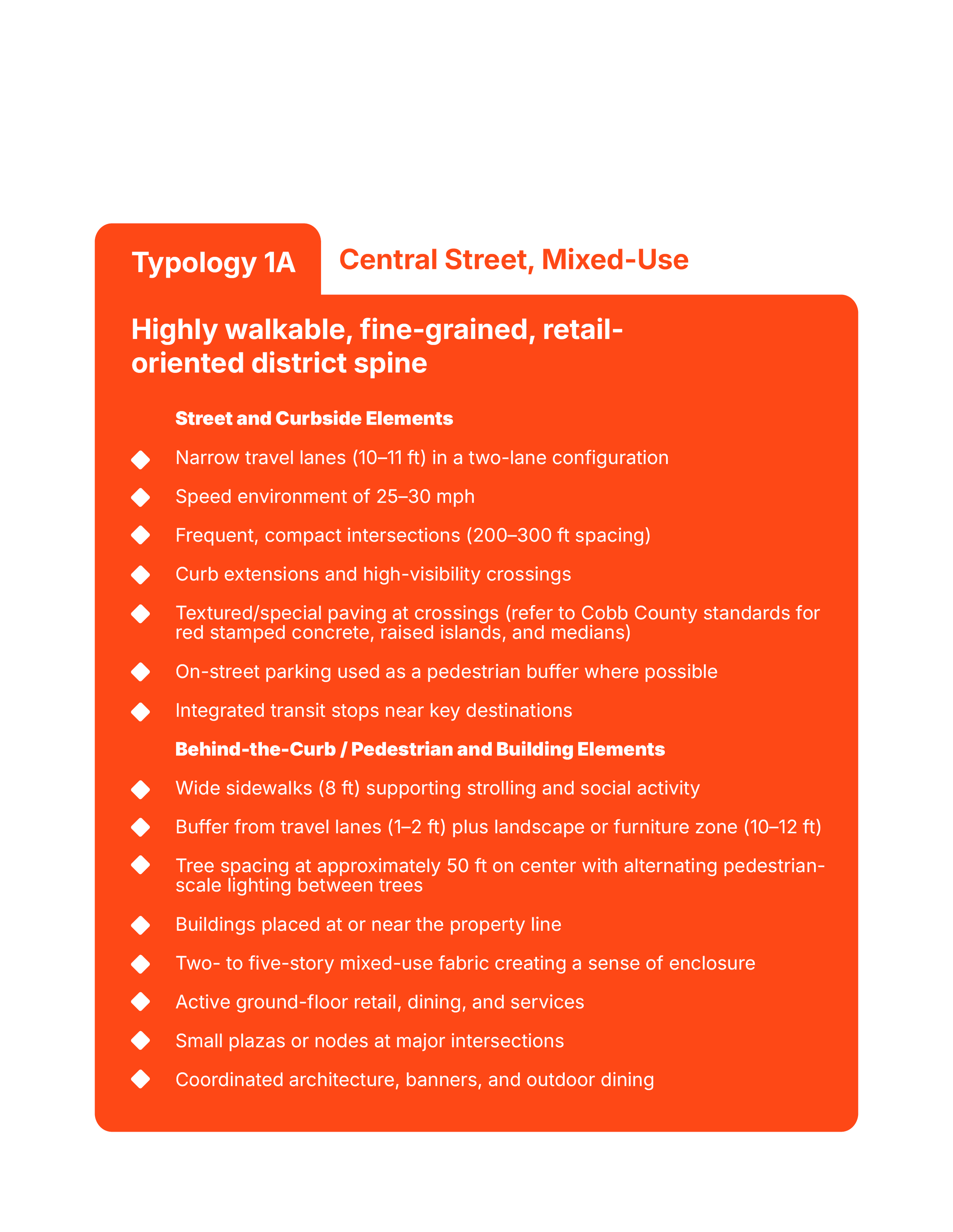
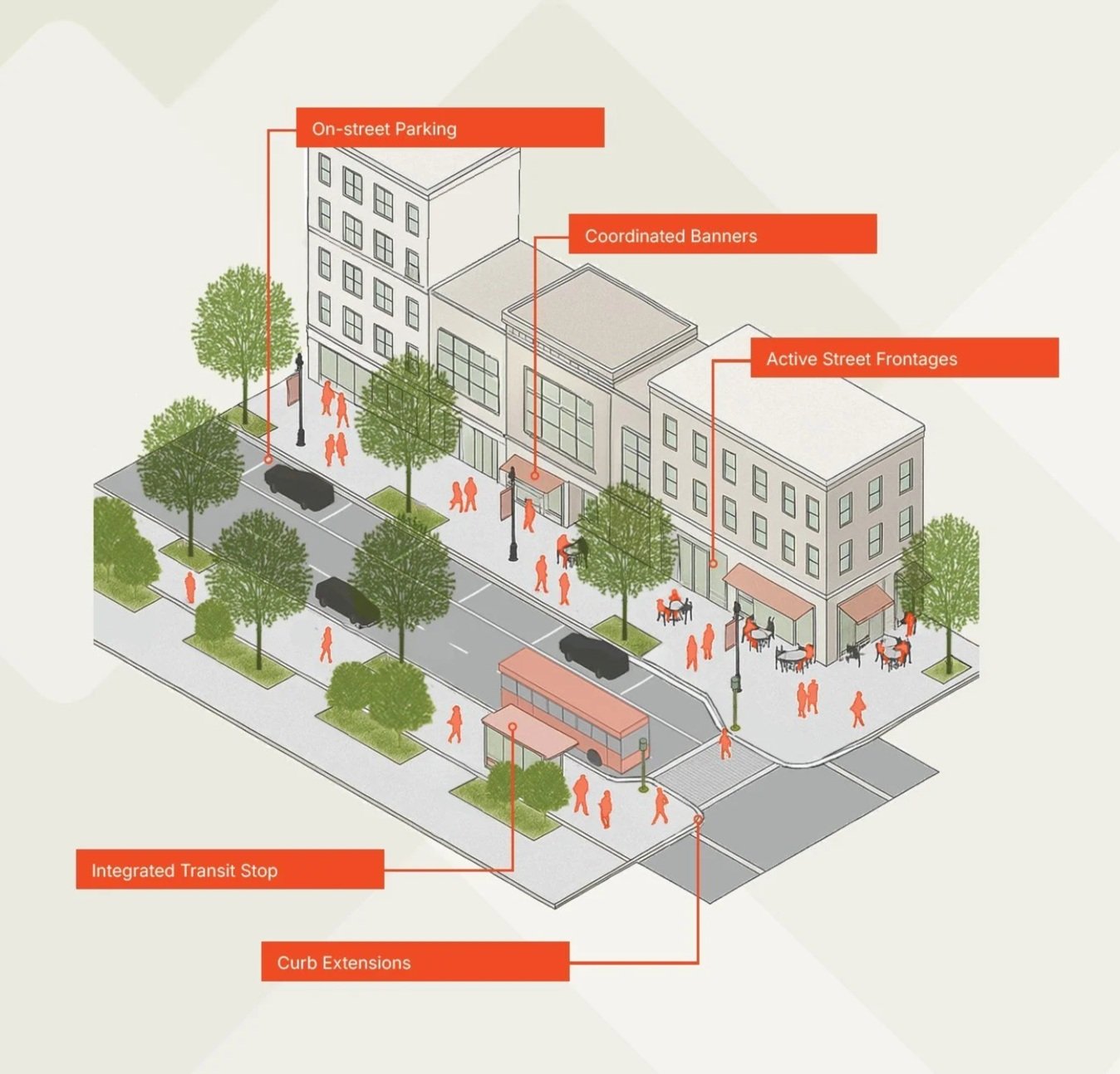
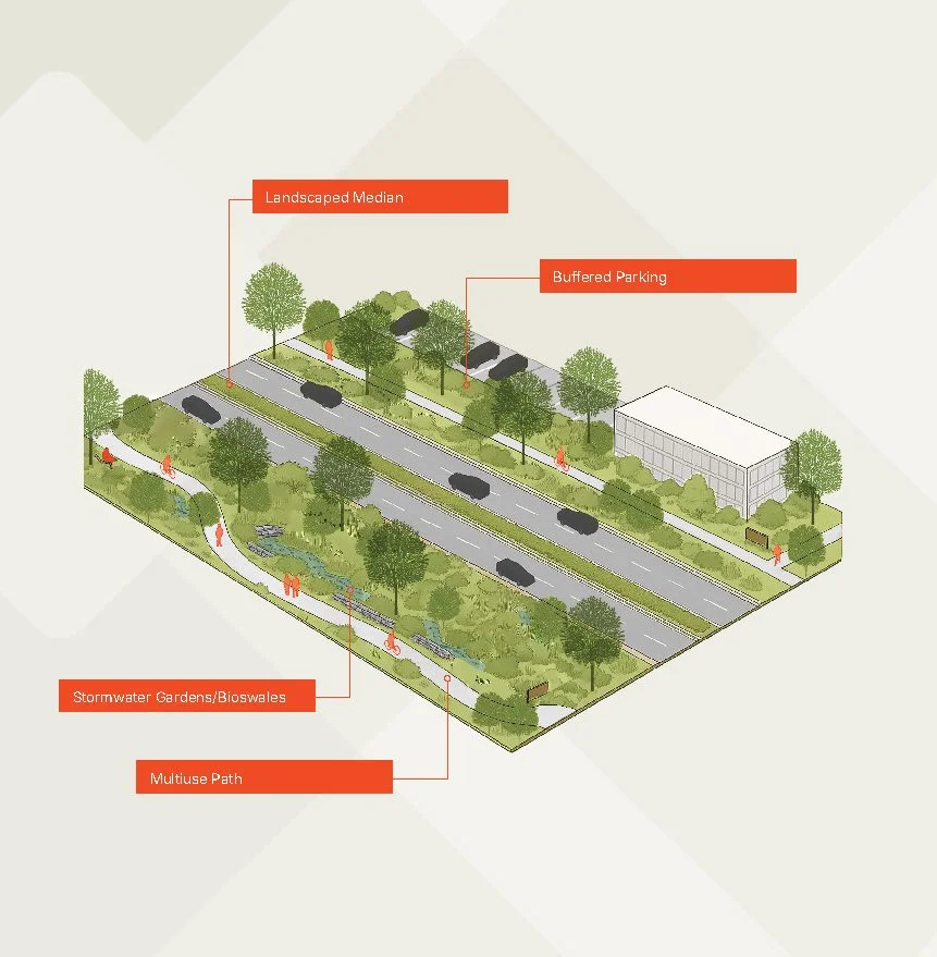
Similarly, Barrett Lakes Boulevard is another important north-south connector in the district. Also located along the Loop, this street currently links industrial uses in the north with commercial uses in the south. It intersects the Noonday Creek Trail and features a portion of the trail running through it toward Aviation Park. This arterial street is primarily designed for cars, with perceived higher speeds, truck traffic, and large setbacks. There is an opportunity to position these streets as complements to one another. George Busbee Parkway would function as a mixed-use Central Street (Typology 1A), while Barrett Lakes Boulevard would serve as a parkway, or a landscaped corridor linking the office, light industrial, and commercial uses along the road (Typology 1B).
Explore other typologies
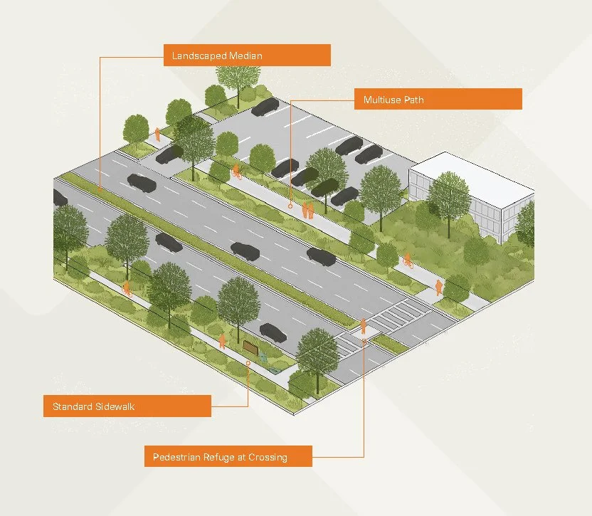
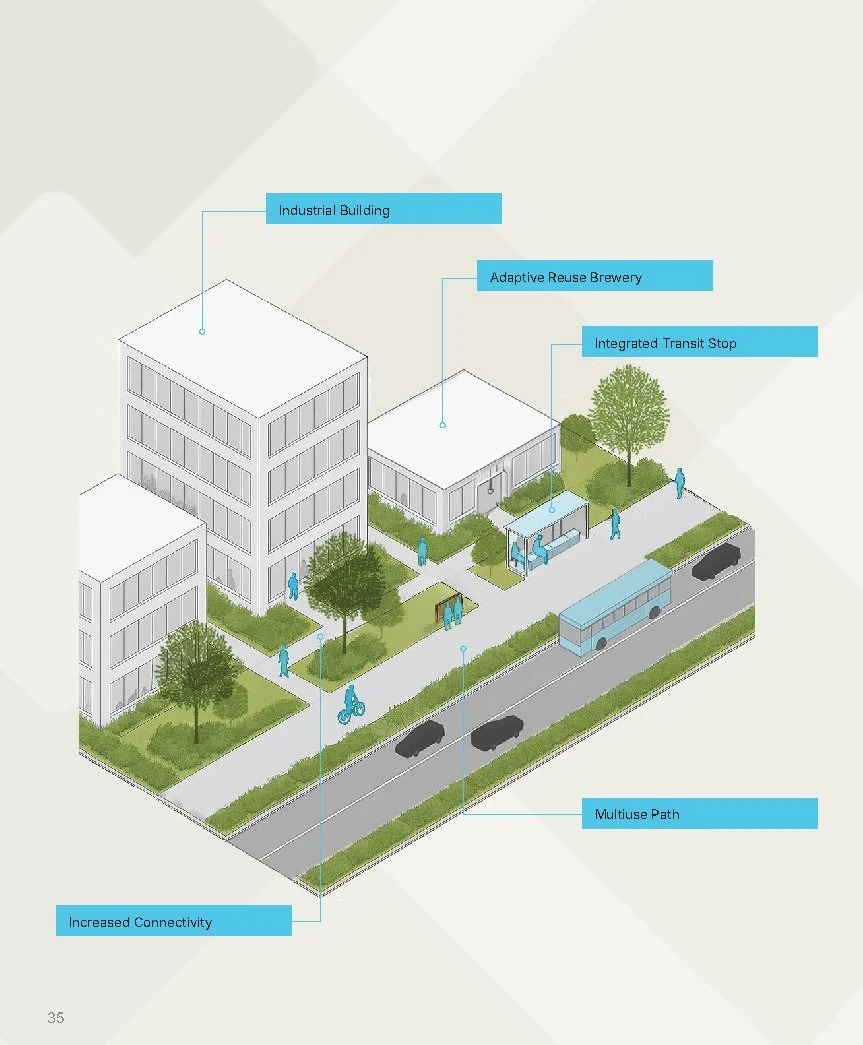
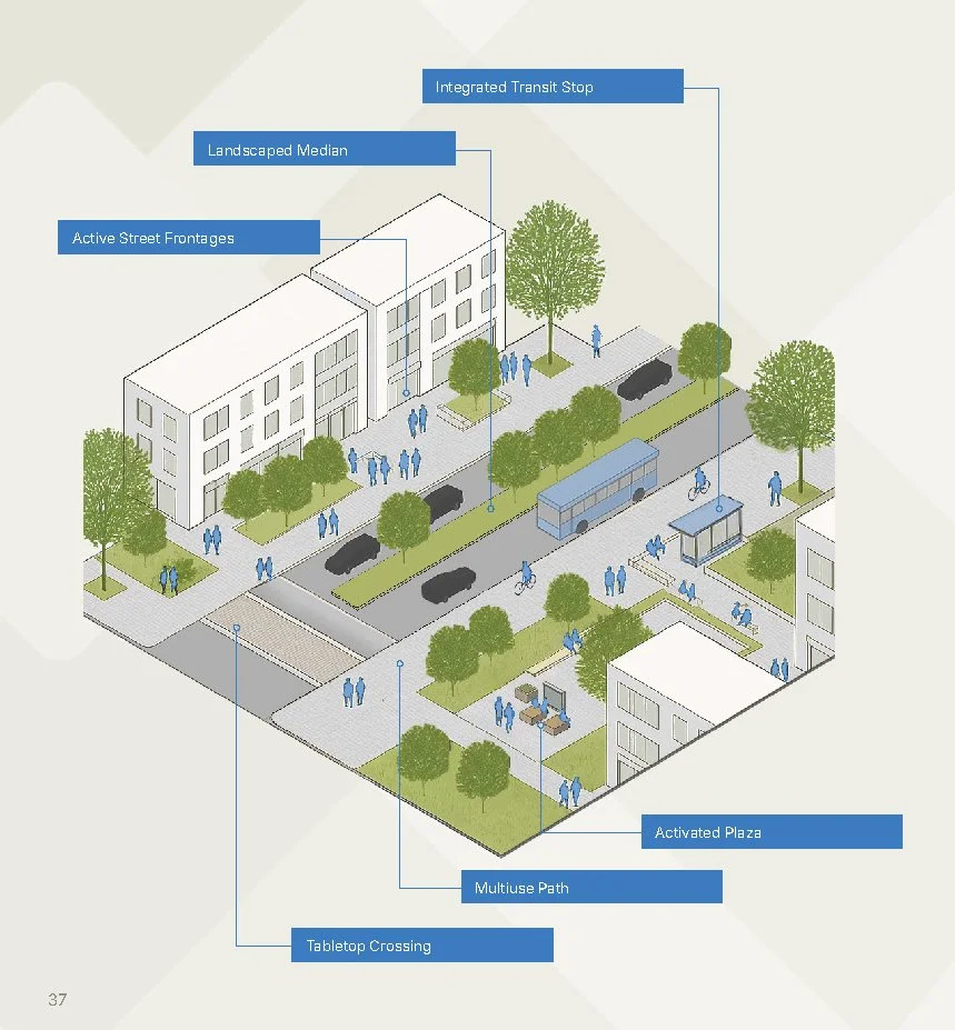
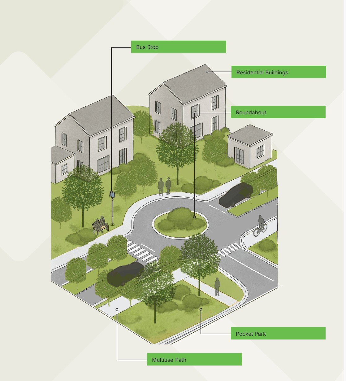
Strategy 3A: Street Network Continuation.
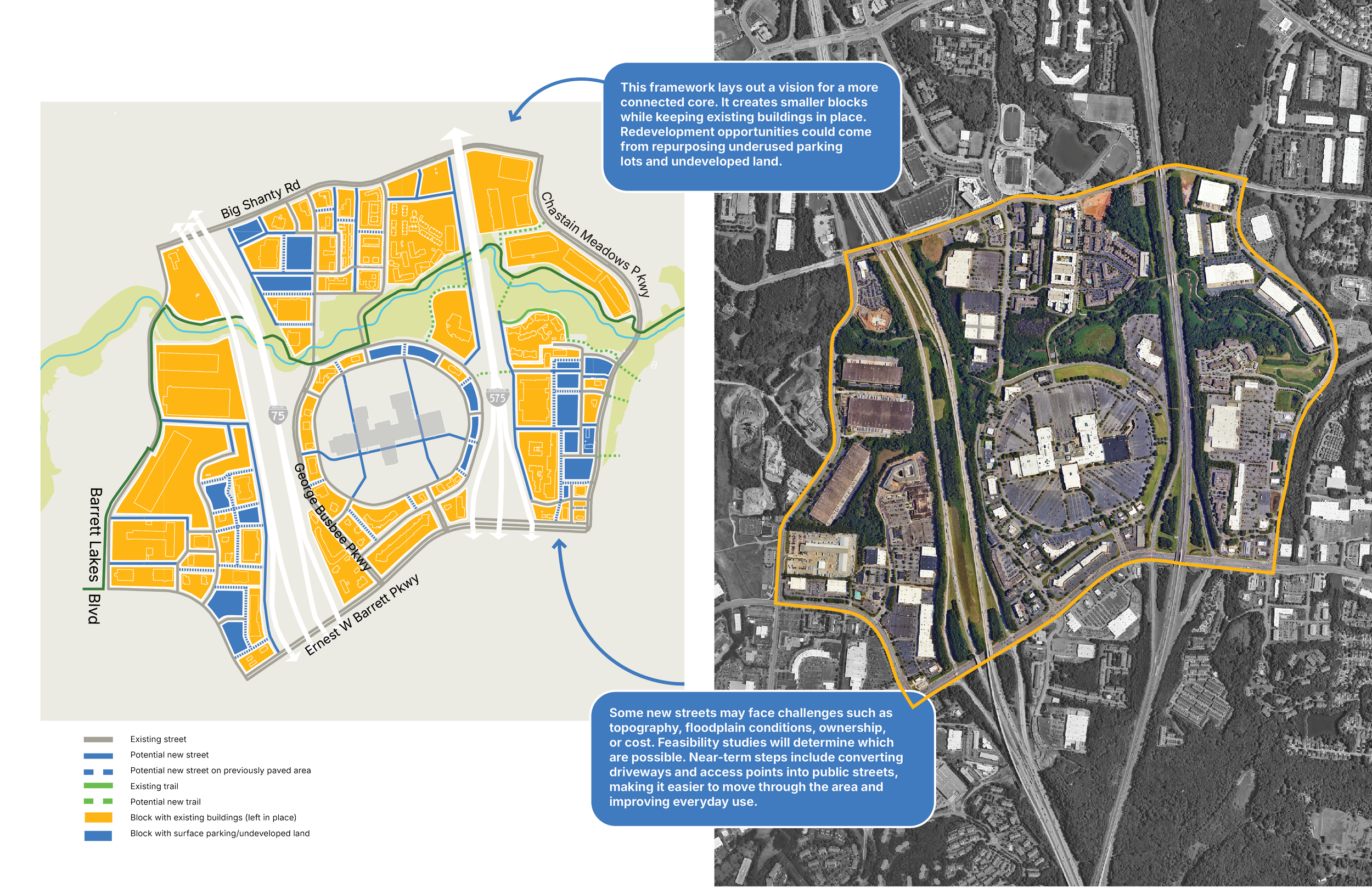
As redevelopment opportunities arise in and around the mall, work with developers to establish a more connected street network that better integrates the mall site into the surrounding parcels. The framework in the following pages lays out a vision for a more connected core. It creates smaller blocks while keeping existing buildings in place. Redevelopment opportunities could come from repurposing underused parking lots and undeveloped land.
Some new streets may face challenges such as topography, floodplain conditions, ownership, or cost. Feasibility studies will determine which are possible. Near-term steps include converting driveways and access points into public streets, making it easier to move through the area and improving everyday use.
Strategy 3B: Strategically Placed Parking.
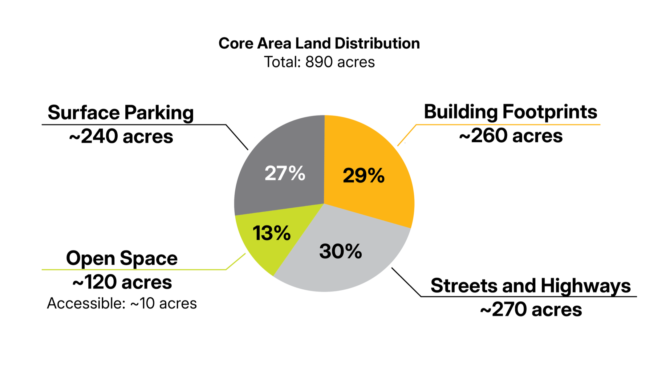
As redevelopment opportunities arise at and around the mall, encourage consolidated parking that creates more space for people and businesses. Design parking and vehicle circulation with pedestrian access and safety in mind. The Town Center Core spans 890 acres, with nearly 60% devoted to streets, highways, and surface parking. This auto-oriented layout undermines walkability and leaves long gaps between destinations. Parking is scattered and overbuilt, with 240 acres dedicated to surface lots alone. Organizing parking into shared, strategically placed decks would reduce vehicle circulation across key pedestrian routes and improve safety for people arriving by foot or bike. Partnering with Cobb County to set a parking maximum could prevent further overbuilding, while peer districts like Dunwoody offer models for turning excess parking into walkable, mixed-use places. Only 120 acres (13%) of the Core are open space, and most of that consists of inaccessible wetlands and buffers. The only accessible portion is about 10,000 linear feet of the Noonday Creek Trail, roughly 10% of the total open space, with no parks currently within the district.
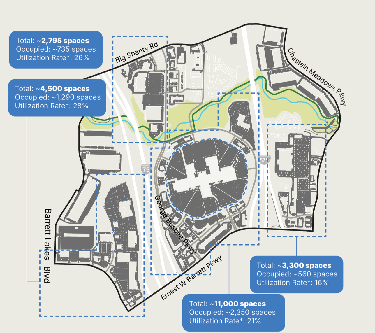
This map highlights the scale of surface parking in the core. The 240 acres of parking contain roughly 21,600 spaces in the commercial area (outside of the mall property), yet average utilization is only about 20%, based on Google Satellite imagery from Sunday, July 13, 2025. While this snapshot doesn’t capture every peak period, it clearly shows that the district has far more parking than it needs. This finding should drive a coordinated parking strategy; one that consolidates parking, reduces excess supply, and frees up land for walkable, mixed‑use development.
JFG Cities Role: Urban Design, Placemaking, and Branding Subconsultant. Project completed in partnership with Gresham Smith.
Client: Town Center CID
Year Completed: 2026