
Cumberland Community Improvement District Livable Centers Initiative
The Cumberland Community Improvement District (CCID) is a thriving hub of business, culture, and activity, but it faces challenges related to connectivity, walkability, and identity. This placemaking strategy builds upon Cumberland’s strengths while addressing its gaps to create a cohesive, vibrant district where people can live, work, and gather.
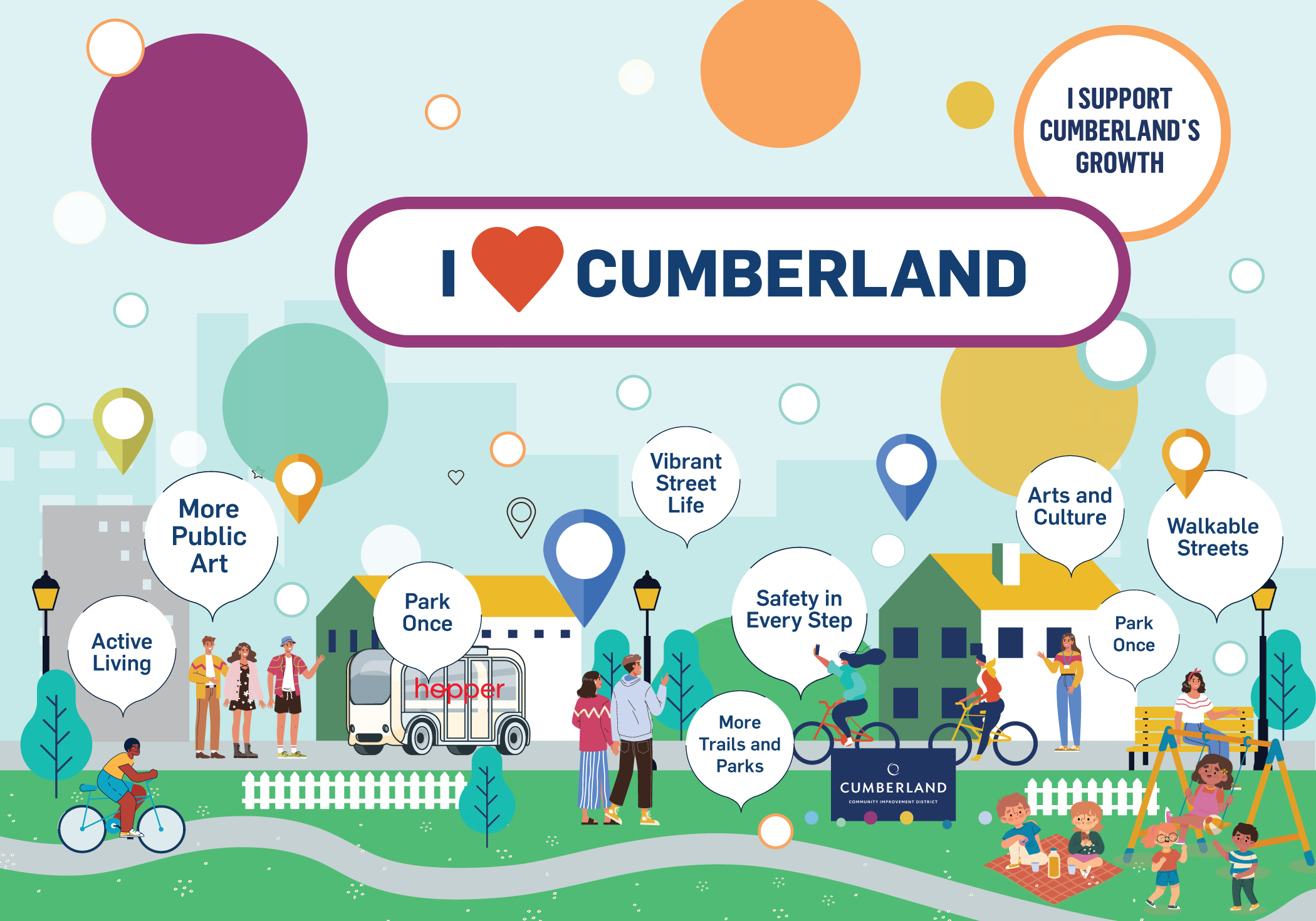
Context
Located at the intersection of two major highways, Cumberland is an edge district in Cobb County, Georgia, situated in an unincorporated area of the northwest Atlanta metropolitan region. Just ten miles northwest of downtown Atlanta, Cumberland is the region’s fifth-largest employment center and a major cultural and entertainment destination. The district is home to prominent landmarks, employment hubs, corporate offices, diverse residential communities, and a growing network of trails and open spaces.
The Cumberland Community Improvement District (CCID) initiates and leads investments and enhancements aimed at making Cumberland an increasingly attractive place to do business, work, live, and visit. Building on other important planning efforts in the district, including Blueprint 4.0, this Placemaking Strategy establishes a framework for strengthening Cumberland’s identity, public realm, connectivity, and sense of place. Some landmarks and points of interest include:
Truist Park
The Cumberland Mural
Cobb Parkway Pedestrian Bridge
The Battery
Paces Mill Palisades
Cochran Shoals Units of the Chattahoochee River National Recreation Area
The Galleria Convention Center
Cumberland Mall
The Chattahoochee River
Trail Systems Including Akers Mill Trail and Bob Callan Trail
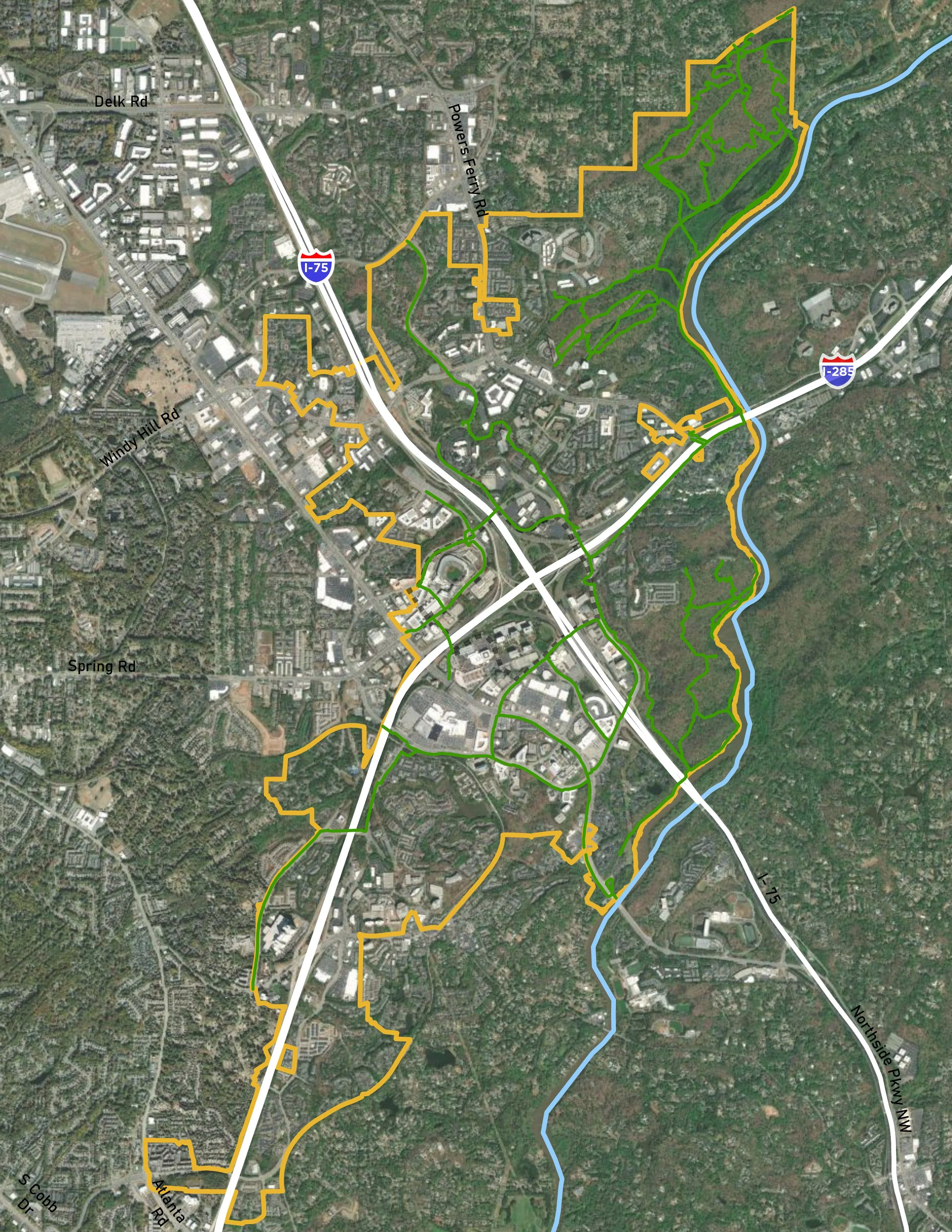
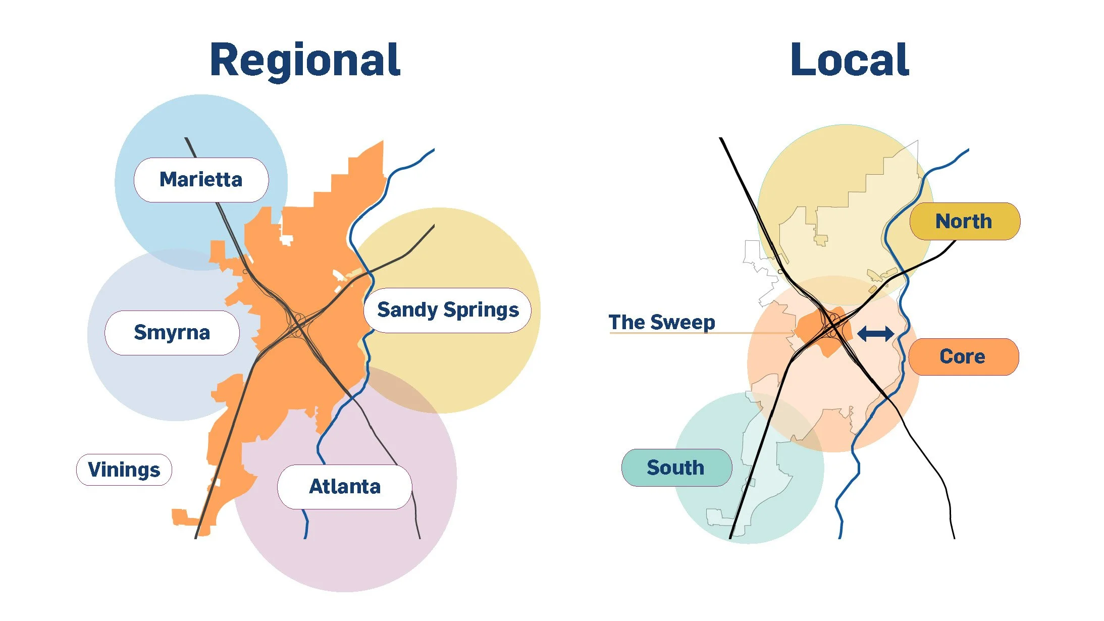
Cumberland’s central location and proximity to surrounding communities position it as an important crossroads. Within the district, the Cumberland Sweep is envisioned as an autonomous vehicle and micromobility strategy organized around the two major highways, helping bridge the pedestrian disconnects they have created. The Sweep connects the North, Core, and South areas identified in Blueprint 4.0, linking key destinations across the district.
The Chattahoochee River is another major asset, creating an important opportunity to better connect Cumberland to the river. This Placemaking Strategy builds on the momentum of the Cumberland Sweep to strengthen these connections and create a more cohesive district.
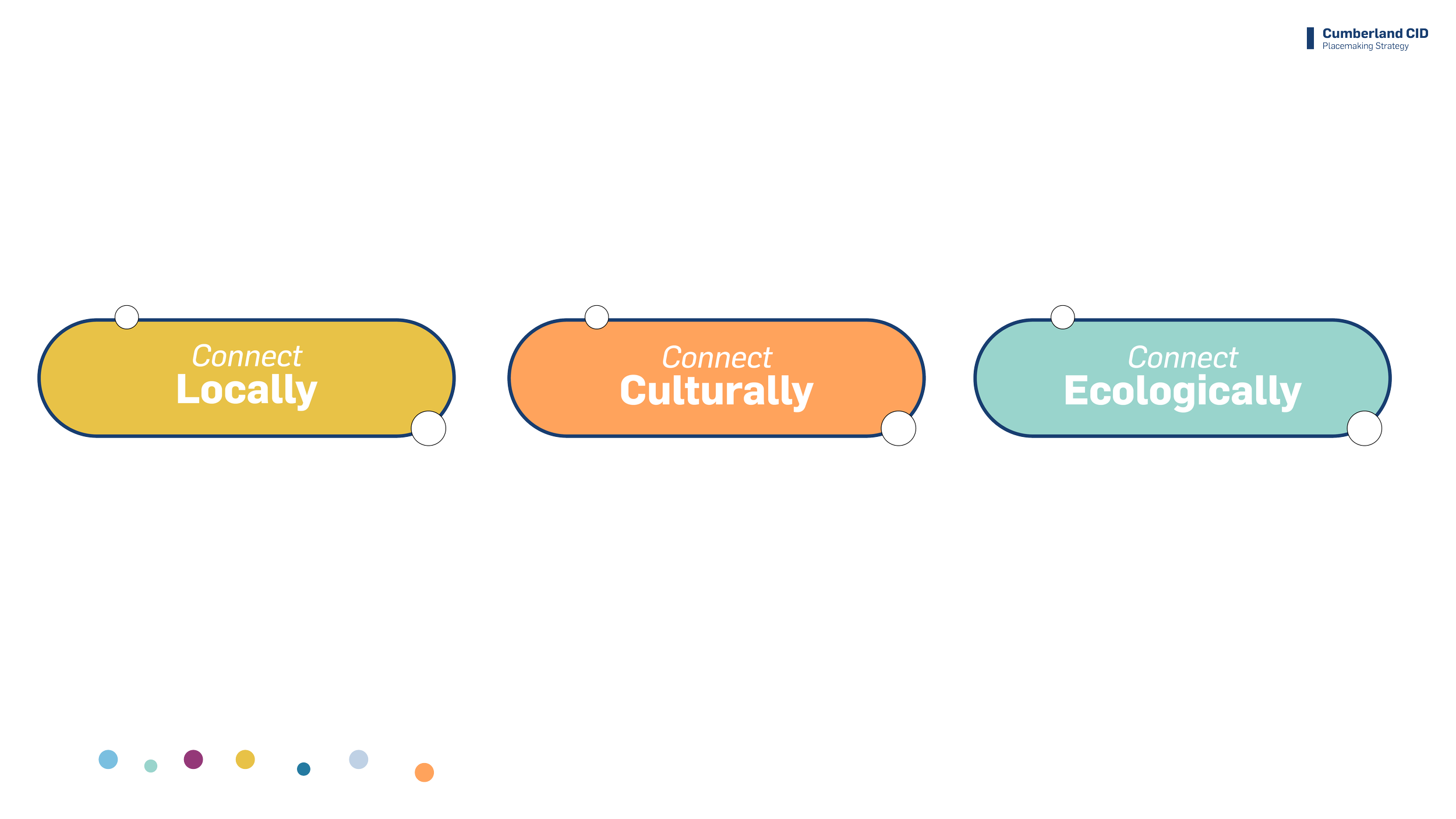
Ecologically: Cumberland’s access to the Chattahoochee River National Recreation Area, the river, and an expanding trail network creates a strong opportunity to establish an ecological framework guiding future growth toward a greener, more connected district. This Strategy identifies that framework as the next step.
Culturally: Home to a thriving arts and culture community, the Cumberland CID area seeks to continue implementing strategies that support the arts while growing its community of artists. Recent public art projects in the area have proven successful, and this Strategy will build on that success.
Locally: The Cumberland area is home to thriving businesses and valuable local assets. Residents, workers, and visitors have expressed a need not only to raise awareness of these assets and their locations, but also to create safer and more pleasant connections to them.
The Vision
The Cumberland CID Placemaking Strategy seeks to connect people:
This Strategy proposes to accomplish these three goals by:
1. Capitalizing on the impact and momentum of the Sweep as one of its most transformative projects under development. By focusing on its path, this Strategy will help create a pilot and demonstration project that can begin to inform placemaking strategies for the rest of the district.
2. Setting the stage for the development of the ecological framework mentioned above.
The Sweep, or cultural loop as named in this Strategy, will help accomplish the first two goals (connecting people locally and culturally), while the creation of an outer ecological loop will accomplish the third one.
By focusing on pilot projects across these three scales, the Cumberland CID is laying the groundwork for future placemaking strategies with greater impact.
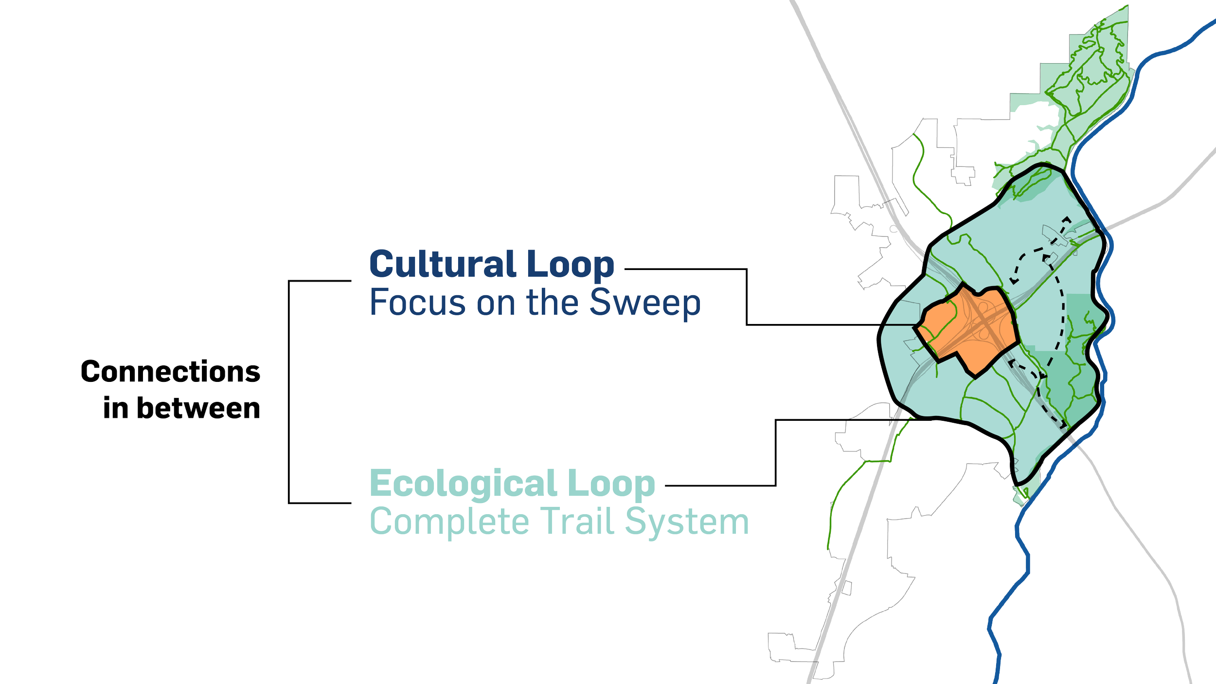
A Peek Into The Cultural Loop
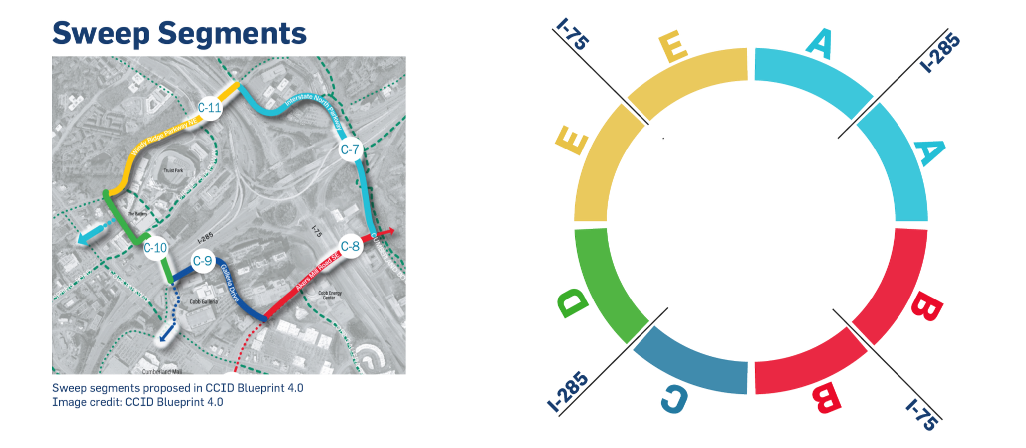
The Sweep Segments:
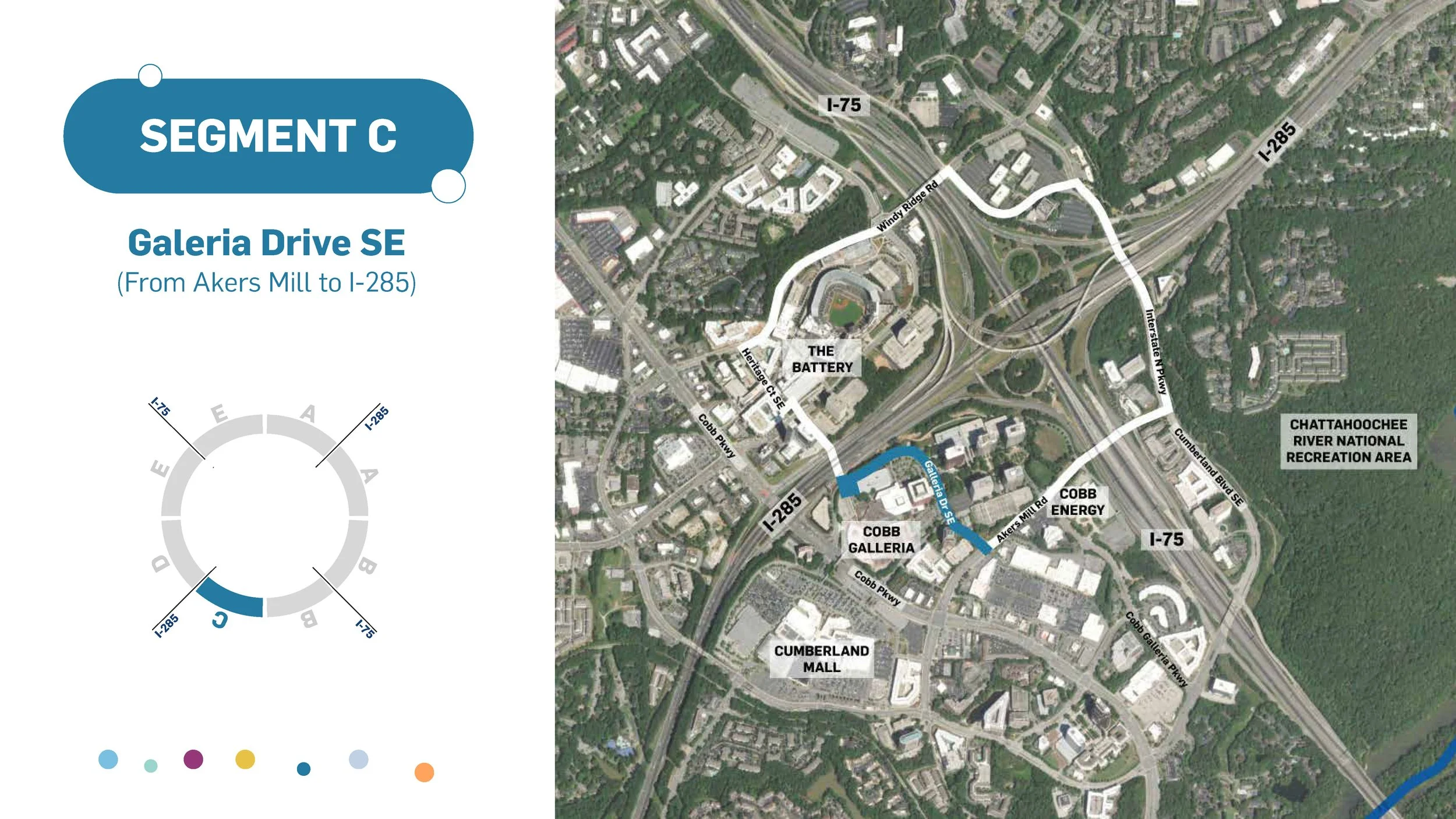
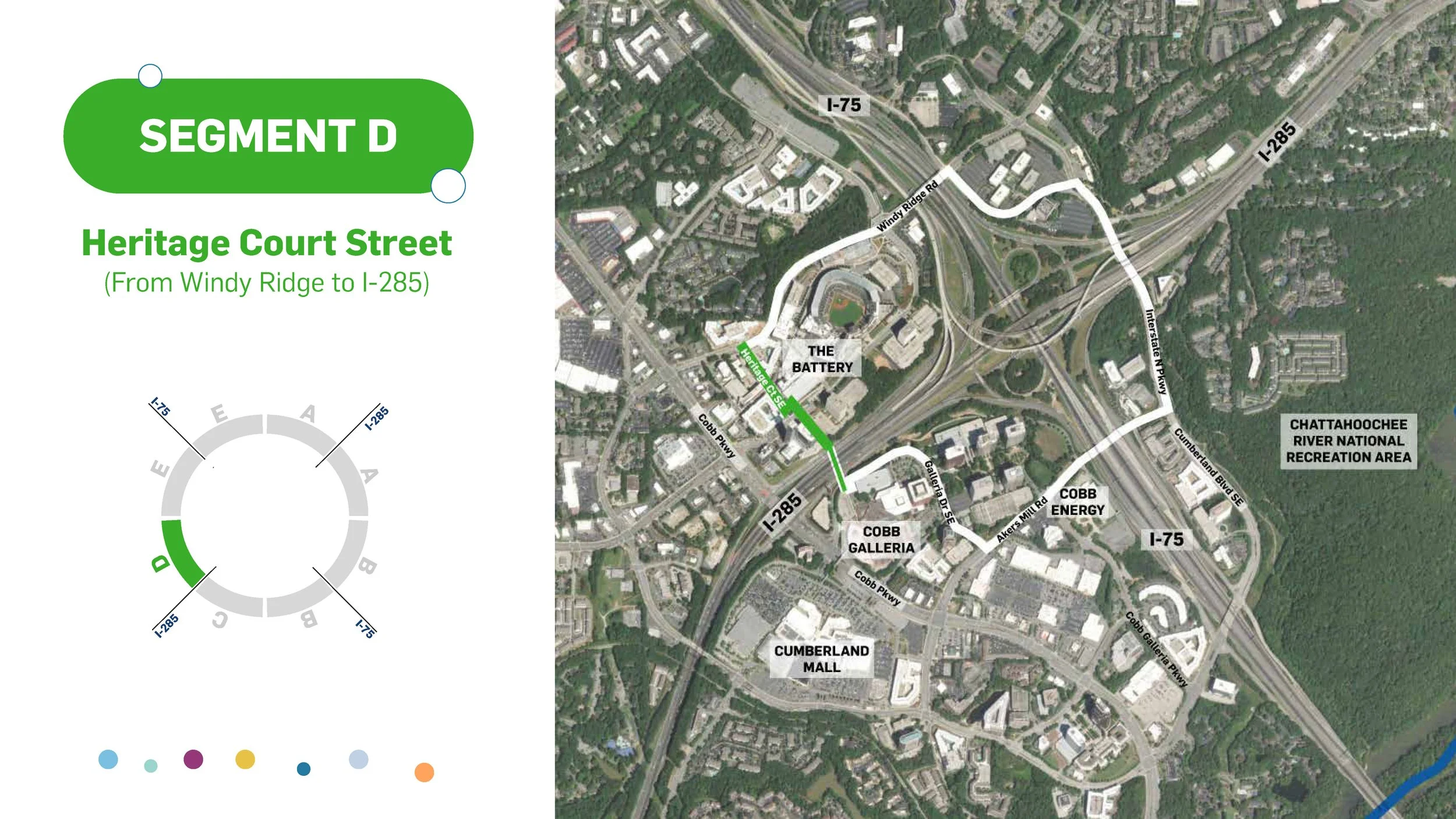
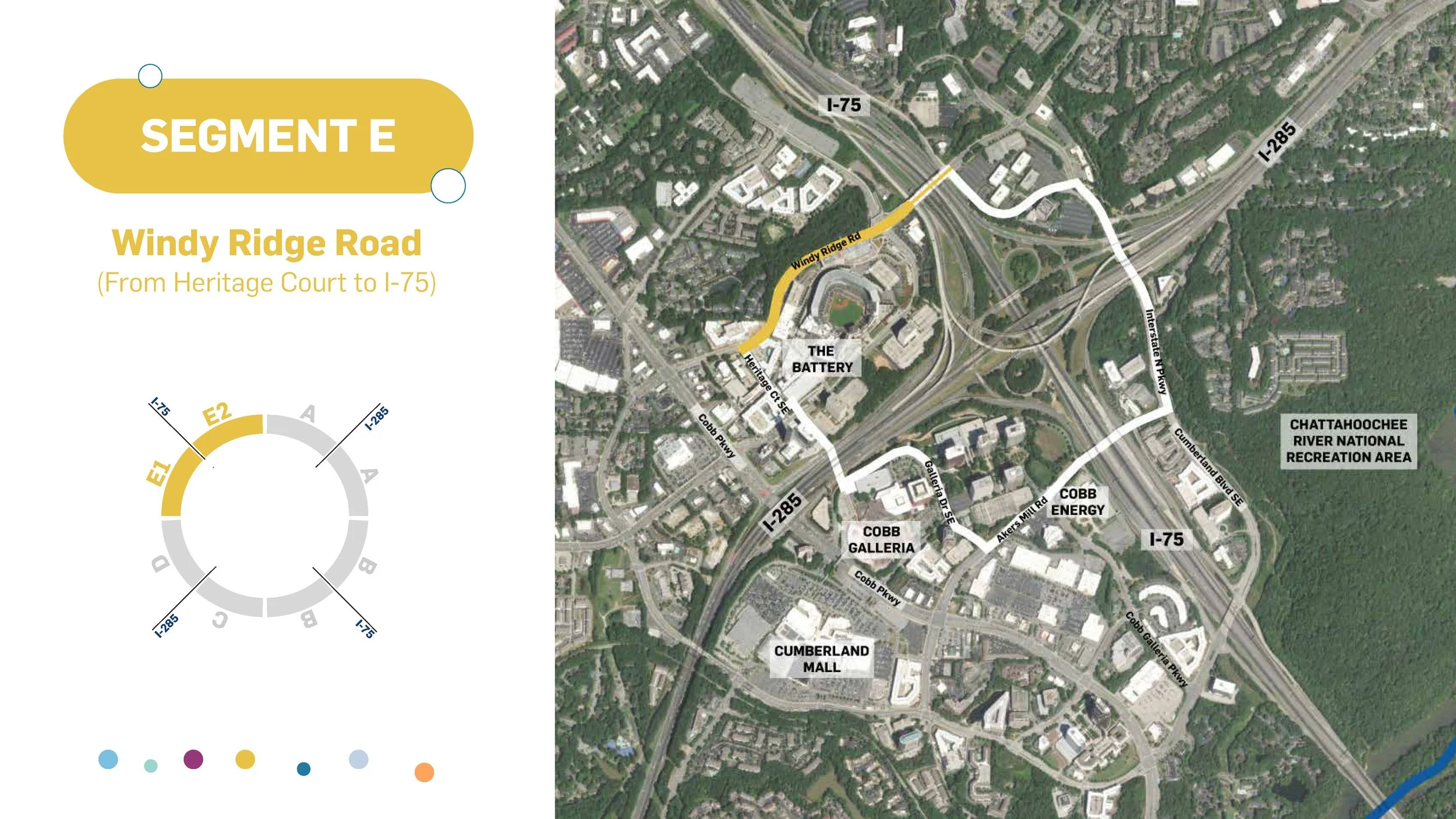
The Cumberland Sweep consists of multiple segments, each offering unique opportunities for placemaking and connectivity. Building on the segment framework established in Blueprint 4.0, this Strategy organizes recommendations around Segments A through E to help prioritize investments as the Sweep is implemented and establish a distinct identity for each segment through branding, signage, and wayfinding.
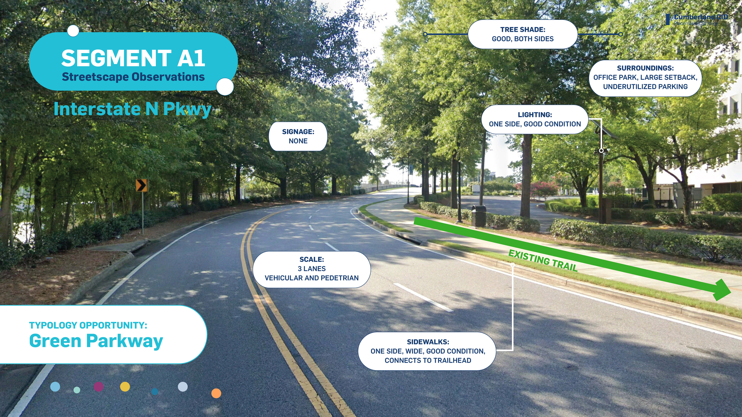
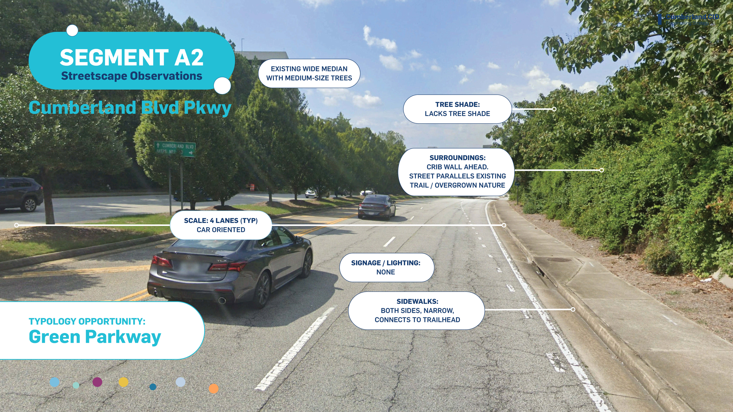
For each segment, the Strategy identifies streetscape observations and opportunity projects ranging from short-term activation to long-term development, creating a roadmap for future placemaking investment.
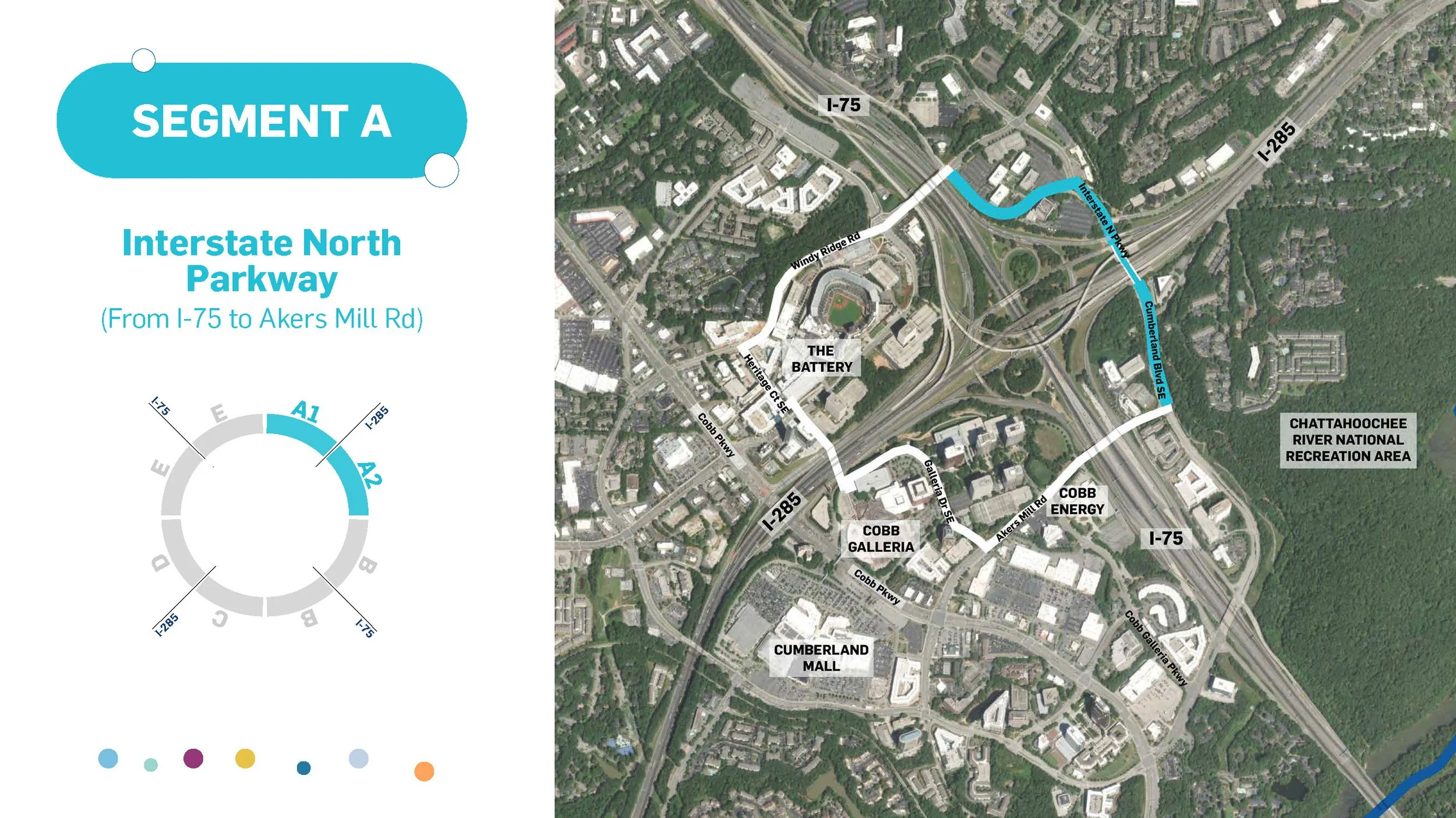
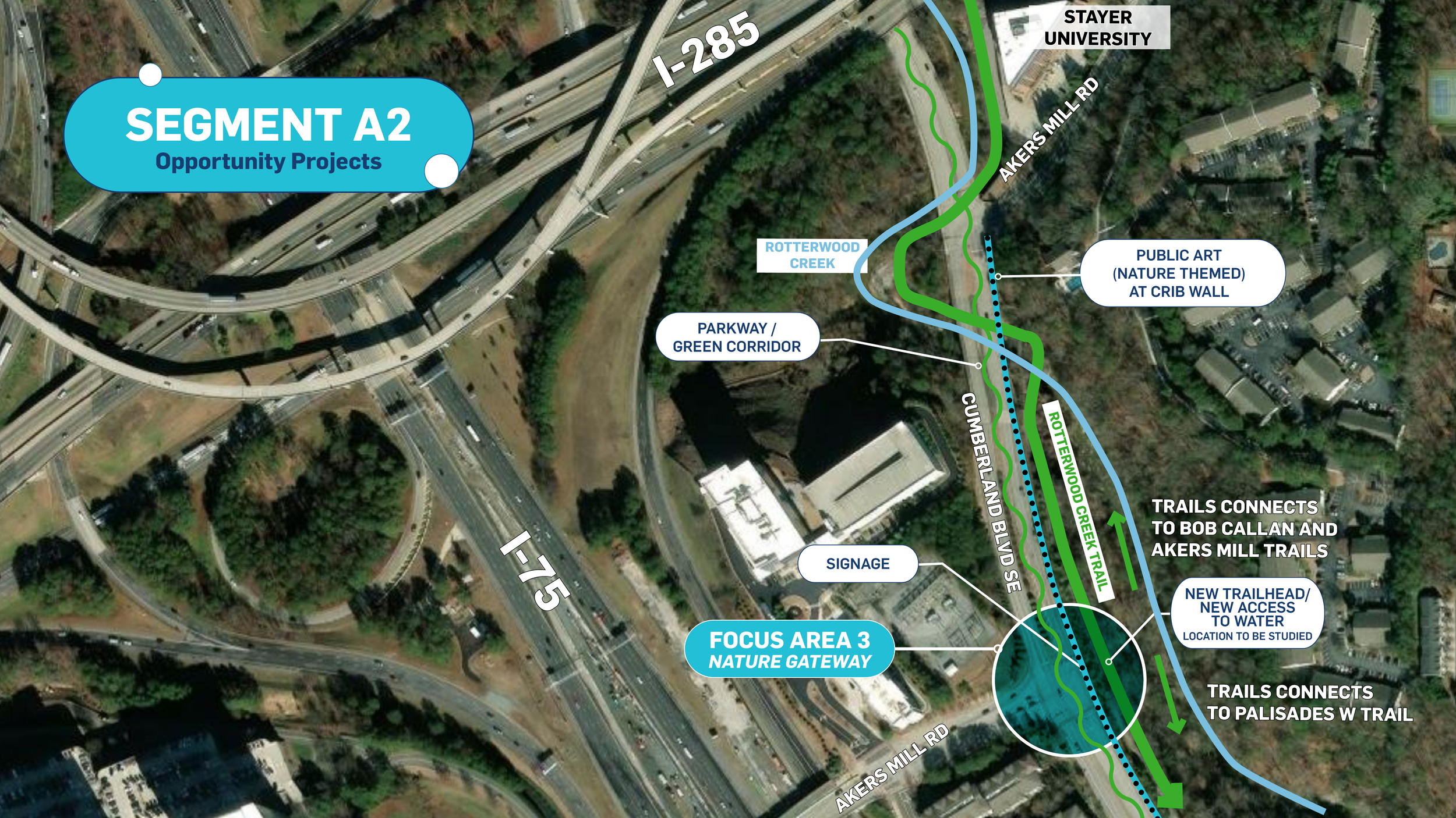
Segment A: Segment A is located north of I-75, connecting key office, business, and green space corridors. Its proximity to I-75 and I-285 positions it as an important gateway into Cumberland. However, the area is characterized by suburban office parks, limited pedestrian infrastructure, and disconnected natural assets.
Streetscape enhancements, improved greenway connections, and pedestrian- and bicycle-friendly infrastructure can transform Segment A into a more accessible and attractive corridor that better connects businesses, green spaces, and key destinations.
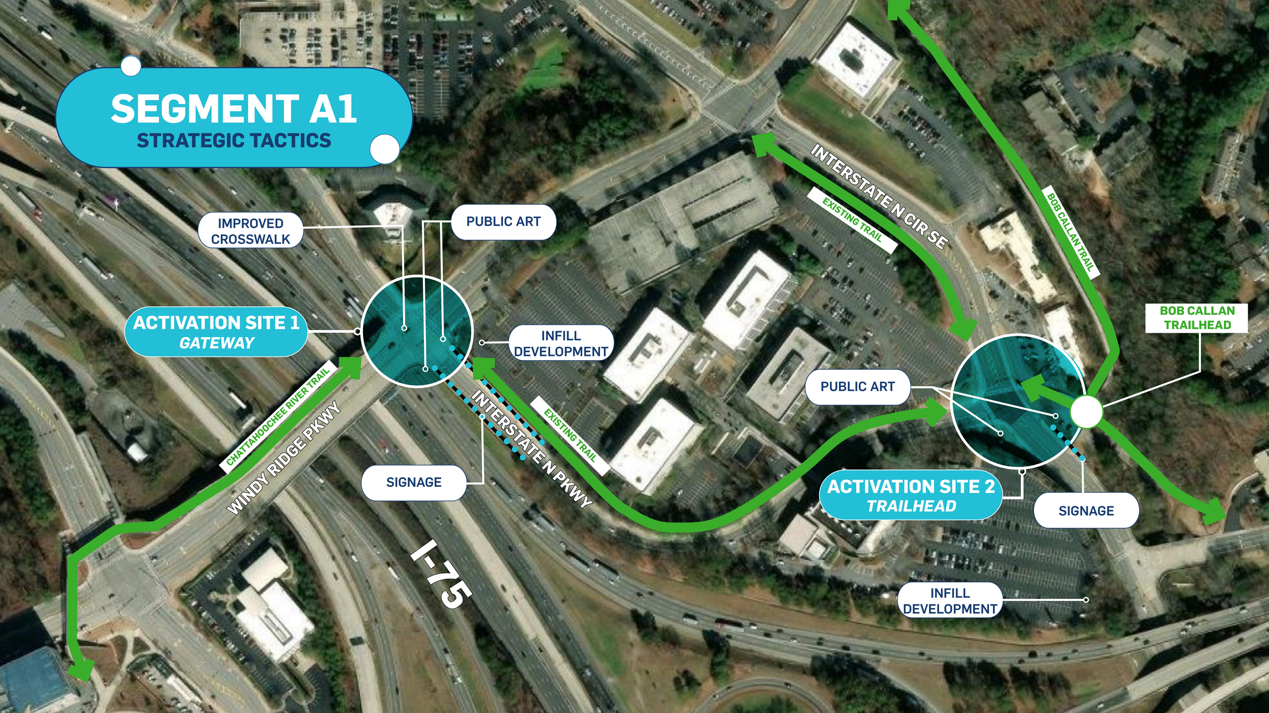
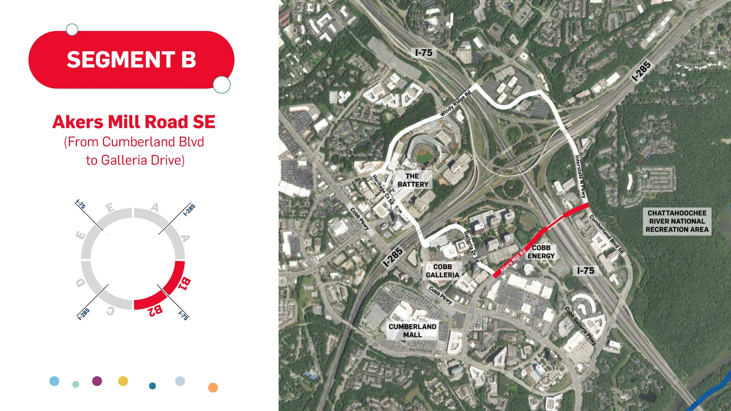
Explore other segments by clicking on the image below.
Demonstration of Placemaking Strategies
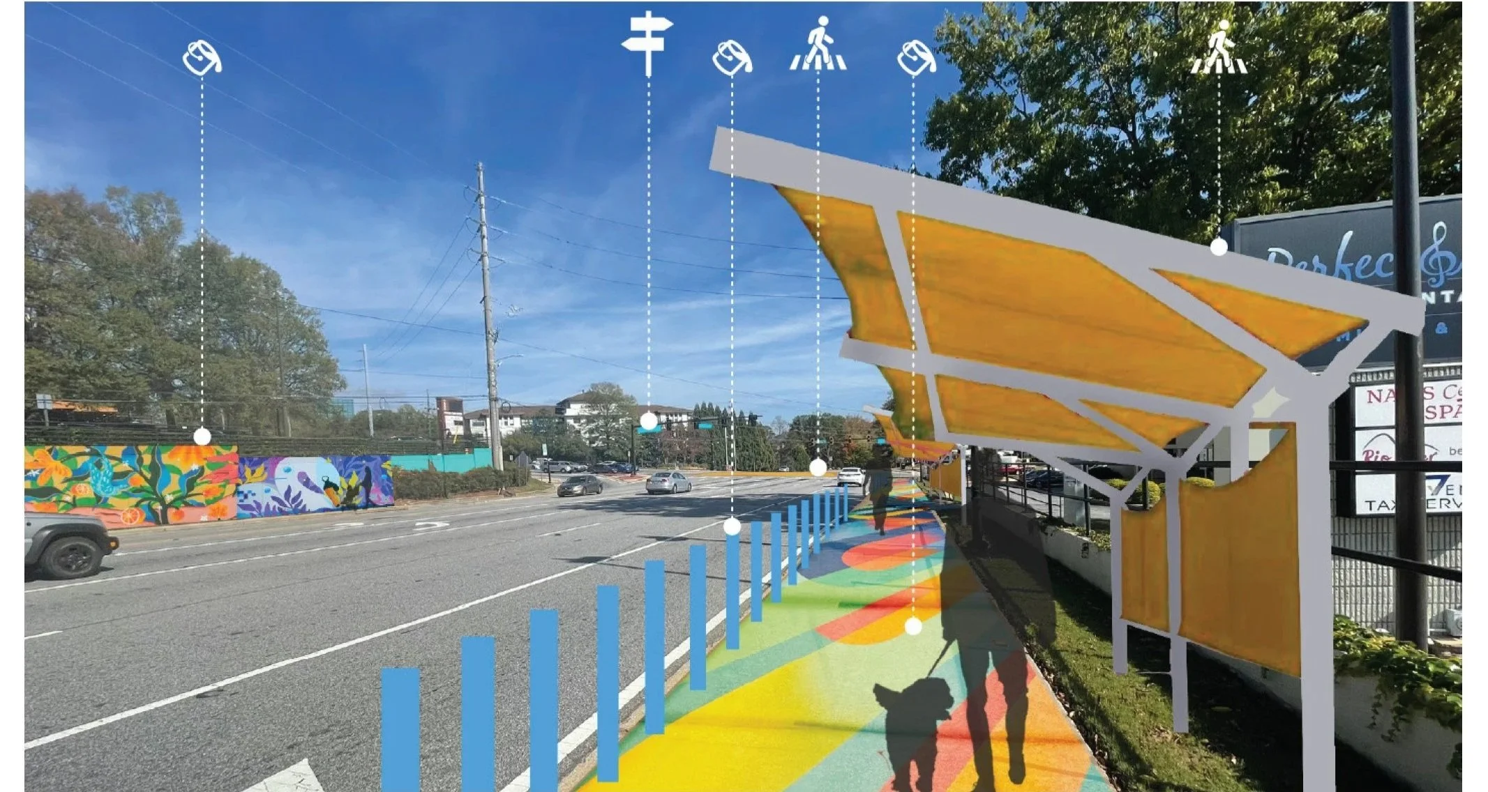
Image courtesy of POND and Formations Studio
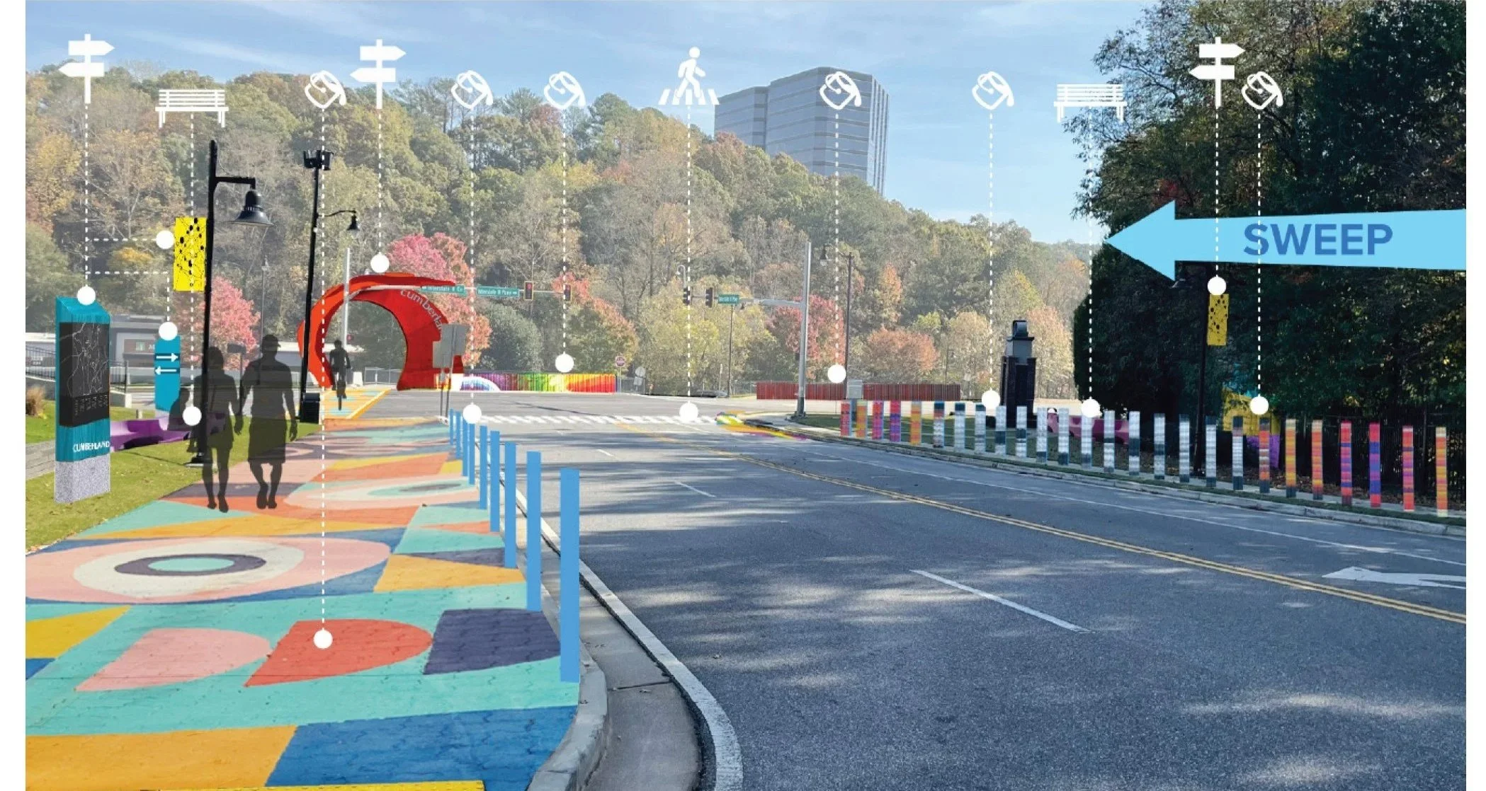
Image courtesy of POND and Formations Studio
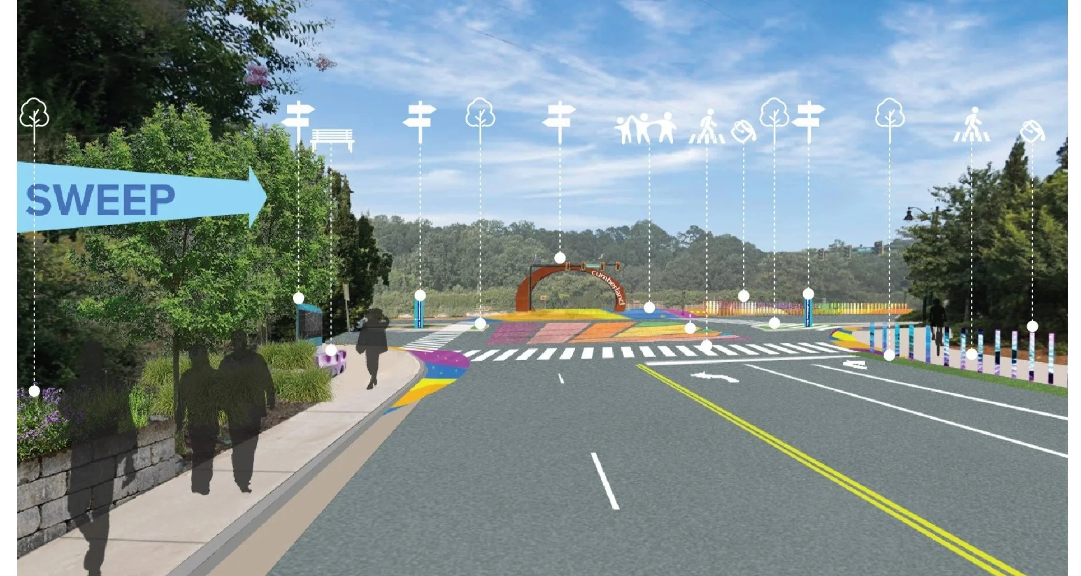
Image courtesy of POND and Formations Studio
JFG Cities Role: Placemaking and Branding Strategist. Project completed in partnership with POND, Purpose Possible, JS&A, and Formations Studio.
Client: Cumberland CID, ARC.
Year: 2025