
DeKalb Stone Mountain Trail Master Plan
A strategic and tactical vision for the trail and the communities it connects.
Overview.
The Stone Mountain Trail Master Plan reimagines a well-used recreational path as a vital civic and regional connector through central DeKalb County. Shaped by more than 2,600 community voices, the plan establishes a framework for mobility, housing and anti-displacement, economic development, placemaking, and safety. Through catalytic projects, near-term improvements, and funding strategies, it transforms the trail into a unifying corridor that strengthens connectivity, celebrates local identity, and supports equitable growth.
Study Area.
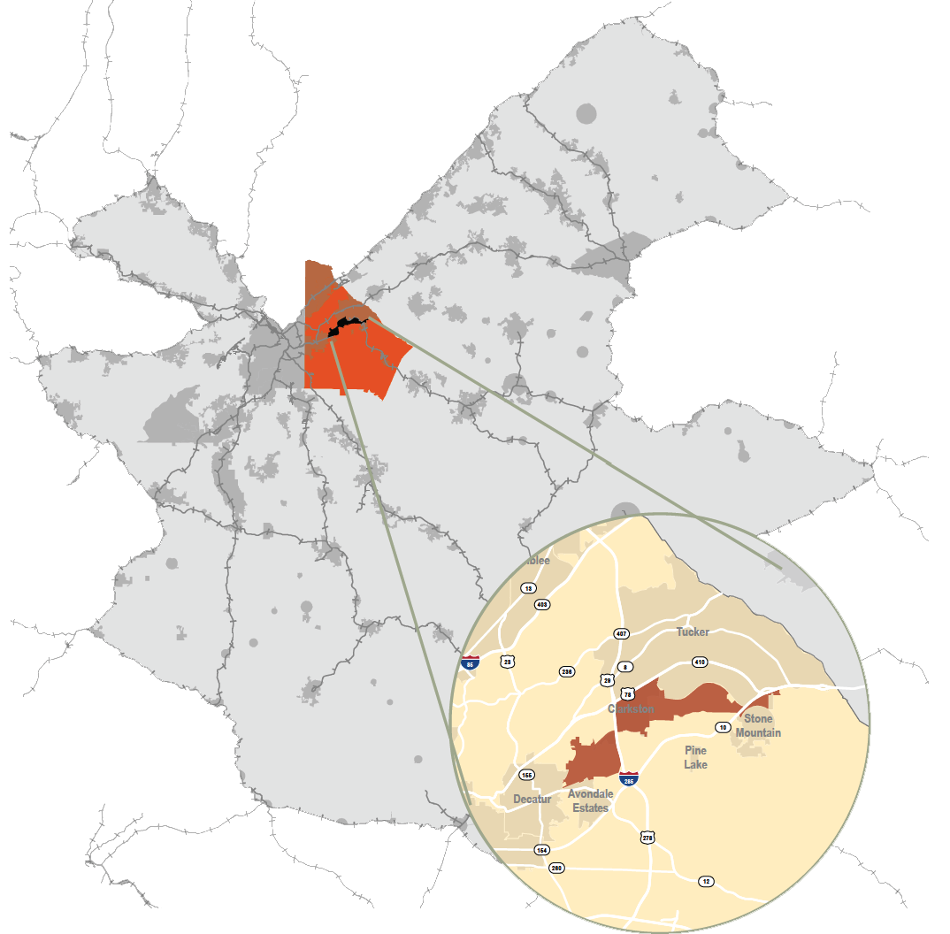
The trail connects the diverse communities of Clarkston, Scottdale, the City of Stone Mountain, and surrounding unincorporated DeKalb County, linking neighborhoods, schools, transit, commercial districts, and employment centers. Each community brings a distinct identity, from Clarkston’s multicultural population and Scottdale’s historic Black neighborhoods to Stone Mountain’s historic downtown and parkland.
The corridor encompasses a mix of residential neighborhoods, aging apartment complexes, industrial sites, and emerging commercial nodes. While some areas are experiencing reinvestment, others face aging infrastructure, housing affordability challenges, and displacement pressures. These conditions underscore the opportunity to leverage the trail as a catalyst for connectivity, neighborhood revitalization, and community-centered investment while preserving the character of each community.
Project Goals.
Three overarching goals guide the Stone Mountain Trail Master Plan: Enhance Connectivity, Strengthen Neighborhoods, and Foster a Sense of Place. Grounded in an anti-displacement approach, these goals address connectivity, access, neighborhood vitality, and community identity.
The plan translates these goals into strategies at two scales: Corridor-wide improvements strengthen trail connections, accessibility, and placemaking, while node-specific interventions focus investment around key catalyst sites. Together, they balance regional connectivity with the distinct needs and character of each community. These goals build on previous plans and extensive analysis, along with extensive community engagement. Explore a quick overview of previous plans and initial analysis.
Design Framework.
The Stone Mountain Trail Master Plan design framework was shaped through an iterative process of technical analysis and community engagement. Recommendations are organized at two scales: corridor-wide strategies that strengthen connections across the study area, and node-specific strategies that address localized needs and opportunities within key activity centers.
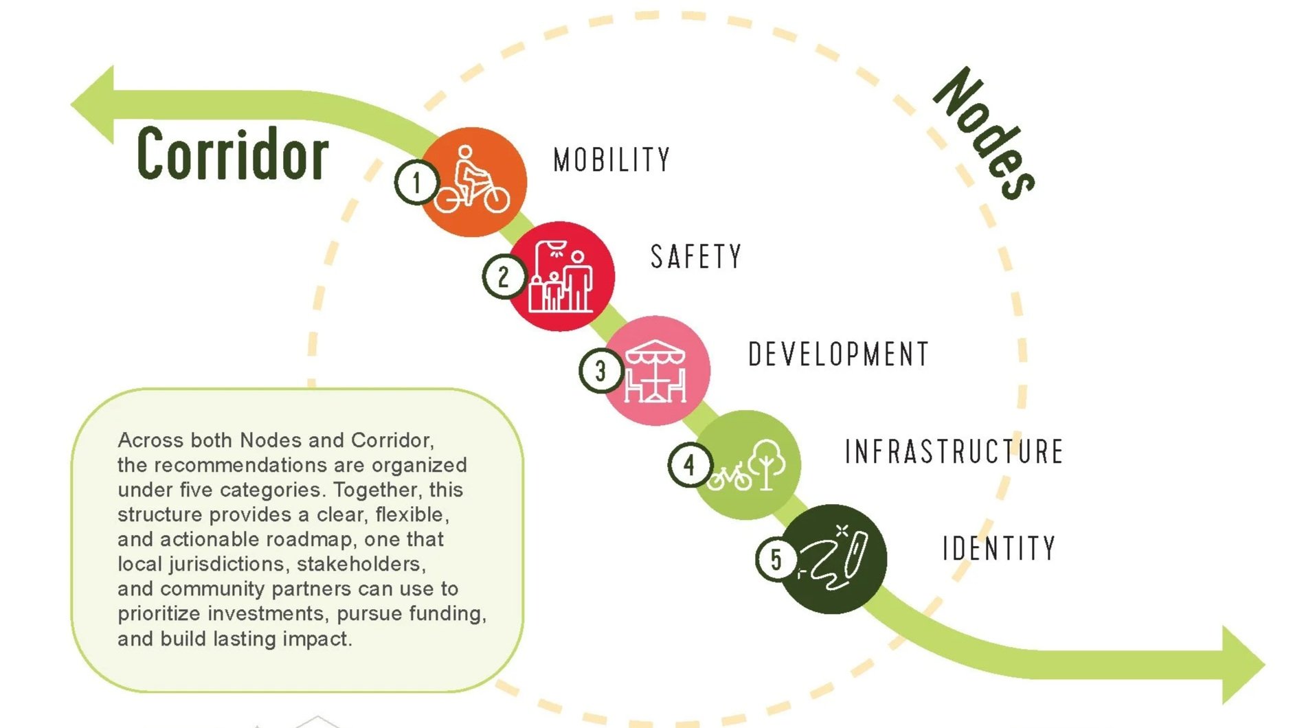
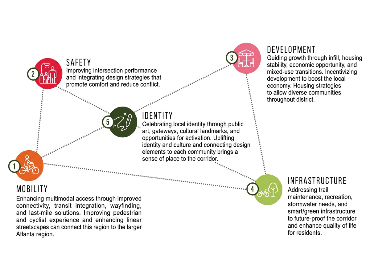
Across both scales, recommendations fall into five interconnected categories: mobility, safety, development, infrastructure, and identity. Together, these categories provide a clear and adaptable framework for implementing improvements that respond to corridor needs and advance the goals of the plan.

Scale 1: The Corridor.
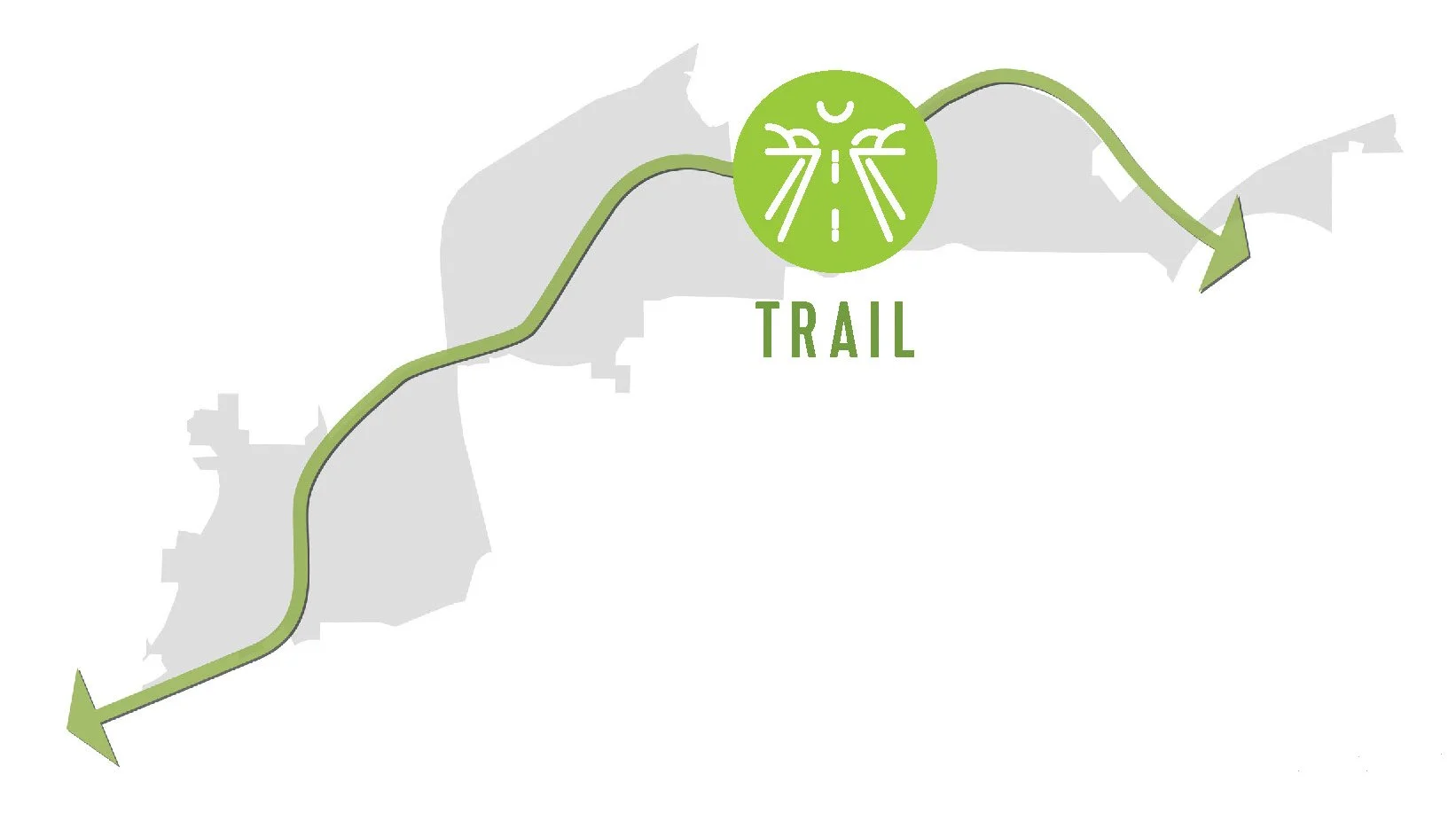
Corridor-wide recommendations address the systems and policies that shape the study area, including mobility upgrades, trail improvements, infill and redevelopment, public art, housing stability, and infrastructure modernization. Together, these strategies establish a framework for transforming the corridor from a vehicle-oriented thoroughfare into a connected, multimodal, and people-centered place. Recommendations include:
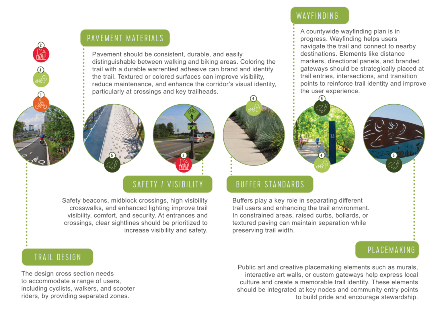
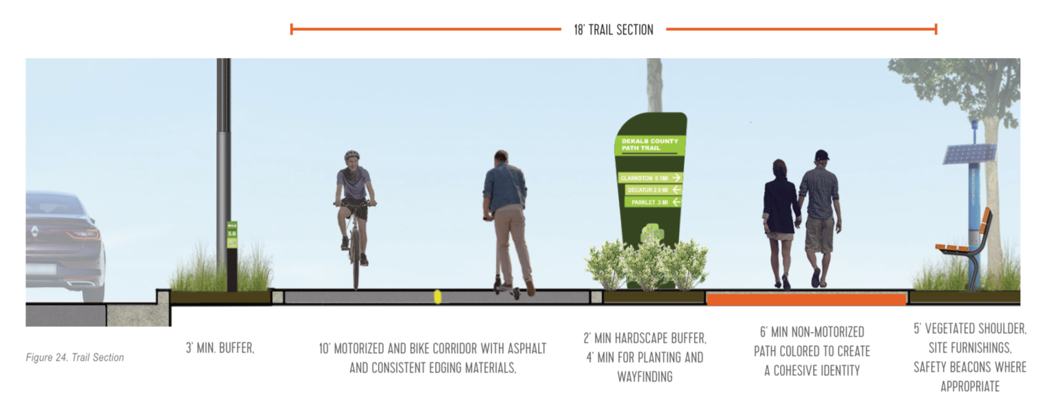
Trail Widening and User Separation
Buffer Standards
Public Art and Interactive Walls
Pavement Materials and Trail Identity
Wayfinding and Signage
Trail Maintenance and Management
Interactive Wayfinding and Accessibility
Safety and Visibility
Iconic Site Furnishings
Smart Trail Infrastructure
Scale 2: The Nodes.
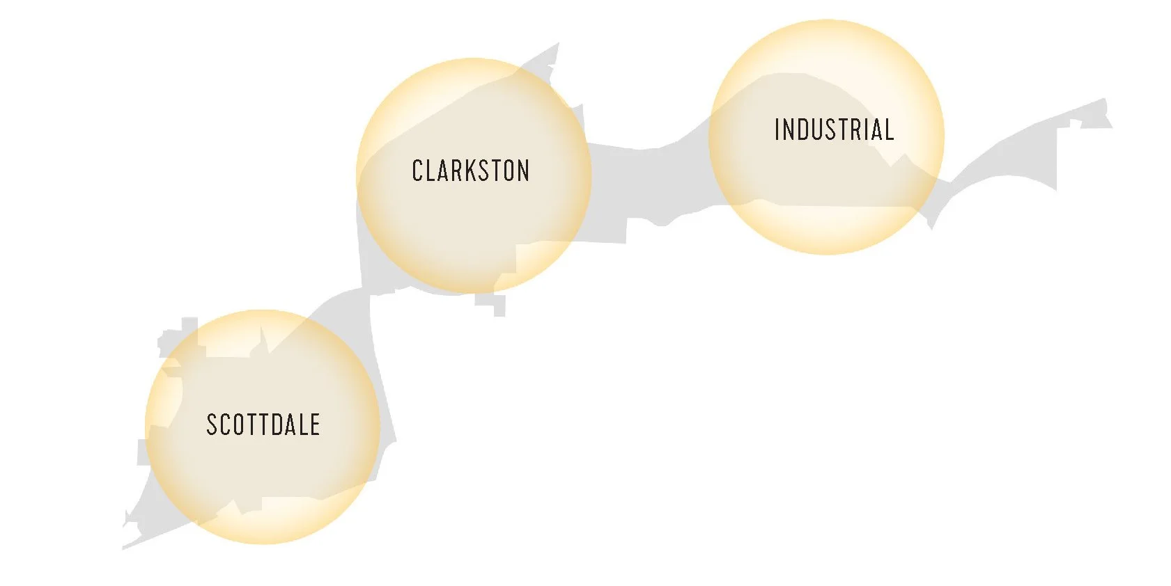
The node-specific recommendations focus on three key areas: Scottdale, Clarkston, and the Industrial Node. Targeted strategies address streetscape improvements, cultural activation, last-mile connectivity, housing diversity, and strategic partnerships. These place-based interventions translate the broader corridor vision into tangible improvements, creating momentum through incremental, community-centered investment. The recommendations include five interconnected design categories that guide improvements across Scottdale, Clarkston, and the Industrial Node. Each category responds to local conditions while reinforcing the broader corridor vision. The five design elements can improve the corridor in strategic areas to meet the 3 primary goals of the project. Enacting these design elements will enhance connectivity, strengthen neighborhoods, and foster a sense of place for the region.
Explore the Nodes.
The Scottdale node recommendations focus on accessibility, housing protections, and strategic development. Key opportunities include proximity to MARTA, established neighborhoods, community landmarks, open space, and vacant land. Challenges include active industrial uses, development pressure, and small parcel sizes.
The Clarkston node recommendations focus on walkability, transit integration, and cultural placemaking, building on existing activity and citywide plans. Key strengths include its vibrant culture, walkable downtown, and South Fork Peachtree Creek. Challenges include food access, roadway barriers, and limited development activation. Explore previous analysis for Clarkston here.
The Industrial Area recommendations focus on safety improvements, infill development, and green buffers. Key strengths include productive industrial properties, an existing transit corridor, dense residential areas, and proximity to Stone Mountain. Challenges include limited greenspace, large industrial parcels and driveways, and disconnected sidewalks.
JFG Cities Role: Placemaking and Branding Strategist. Project completed in partnership with POND, BAE, Blue Cypress
Client: DeKalb County
Year: 2025