
Aerotropolis Atlanta
Blueprint 2.0
A strategic vision for the area surrounding Hartsfield-Jackson Atlanta International Airport
Overview.
Located south of Downtown Atlanta and centered around Hartsfield-Jackson Atlanta International Airport, the Aerotropolis encompasses approximately 176 square miles and a population of roughly 550,000, primarily within South Fulton and Clayton counties. Extending outward from the airport along major transportation and economic development corridors, including Interstates 75, 85, and 285, MARTA’s Red and Gold Lines, and several state and federal highways, the Aerotropolis is uniquely positioned to leverage the airport’s role as a regional and global transportation hub. Building on Blueprint 1.0, Blueprint 2.0 updates the vision and strategies for the area, with a focus on fostering dynamic business and residential communities, strengthening connectivity, and leveraging the Aerotropolis’ assets to support continued economic growth and investment.
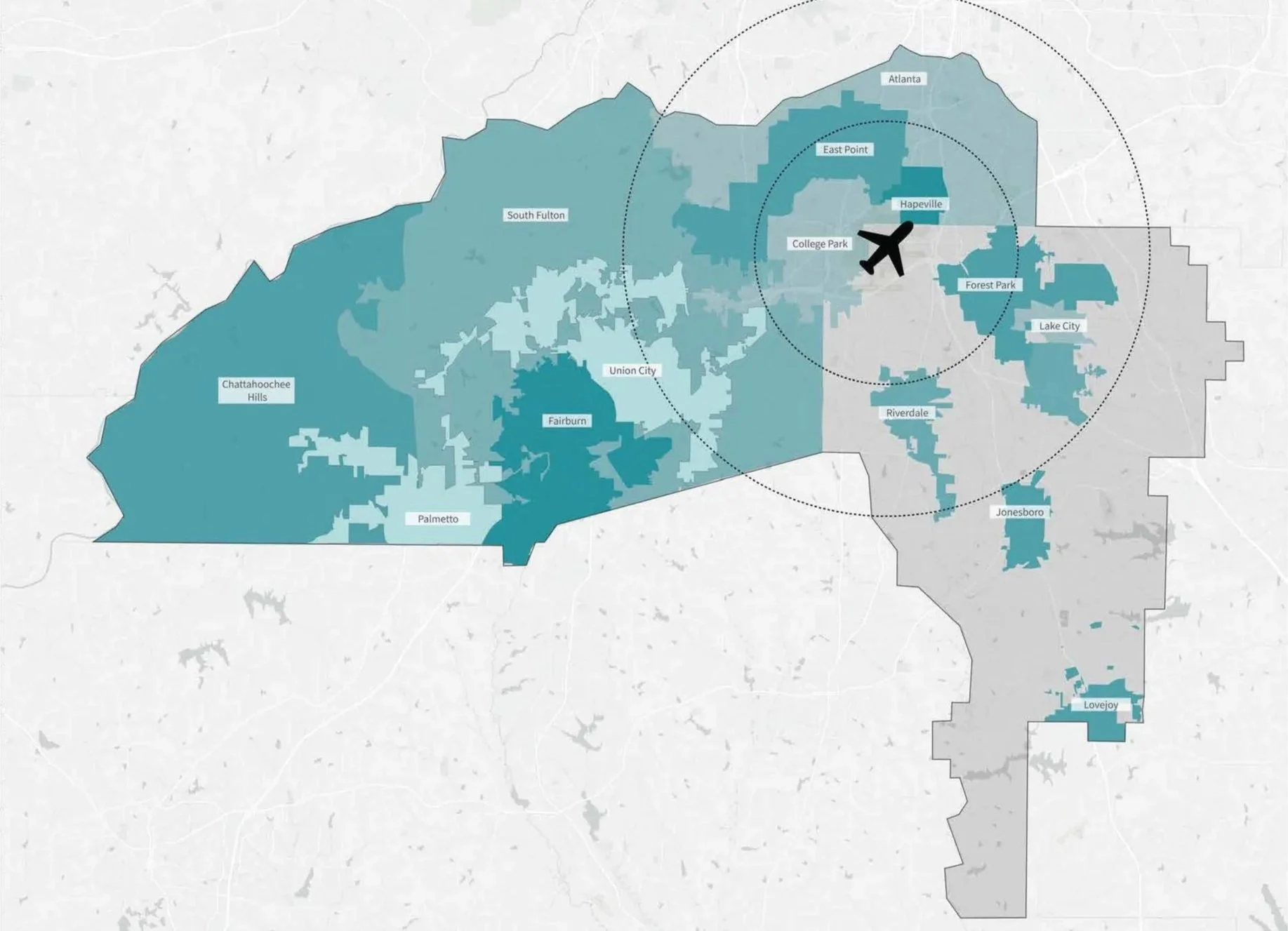
Jurisdictions within the Aerotropolis area include:
Atlanta
College Park
East Point
Fairburn
Forest Park
Hapeville
Lake City
Jonesboro
Riverdale
Union City
Lovejoy
South Fulton
Palmetto
Chattahoochee Hills
Unincorporated Clayton County
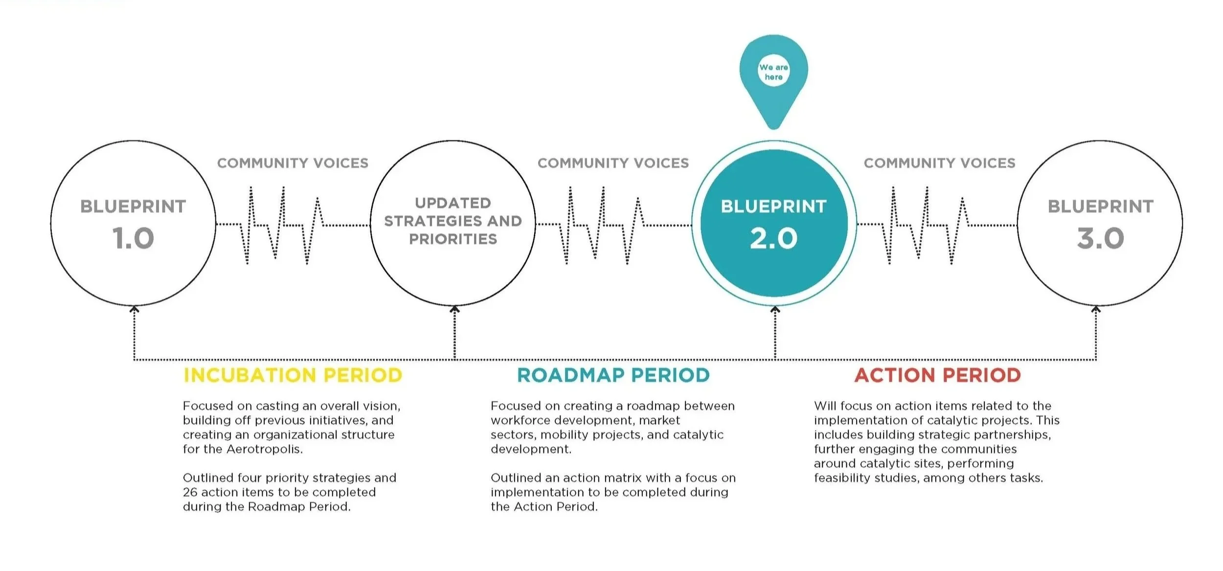
The Aerotropolis Blueprint builds on a continuum of previous and ongoing planning efforts, carrying forward established priorities while responding to evolving needs and opportunities across the region. Blueprint 2.0 serves as the current roadmap in this progression, connecting past planning efforts with future implementation and investment. Explore the Existing Planning Initiatives Map.
Approach: Impact Areas.
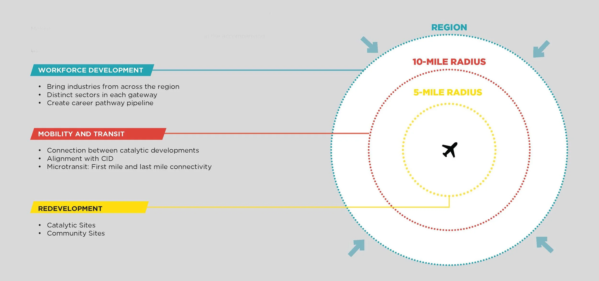
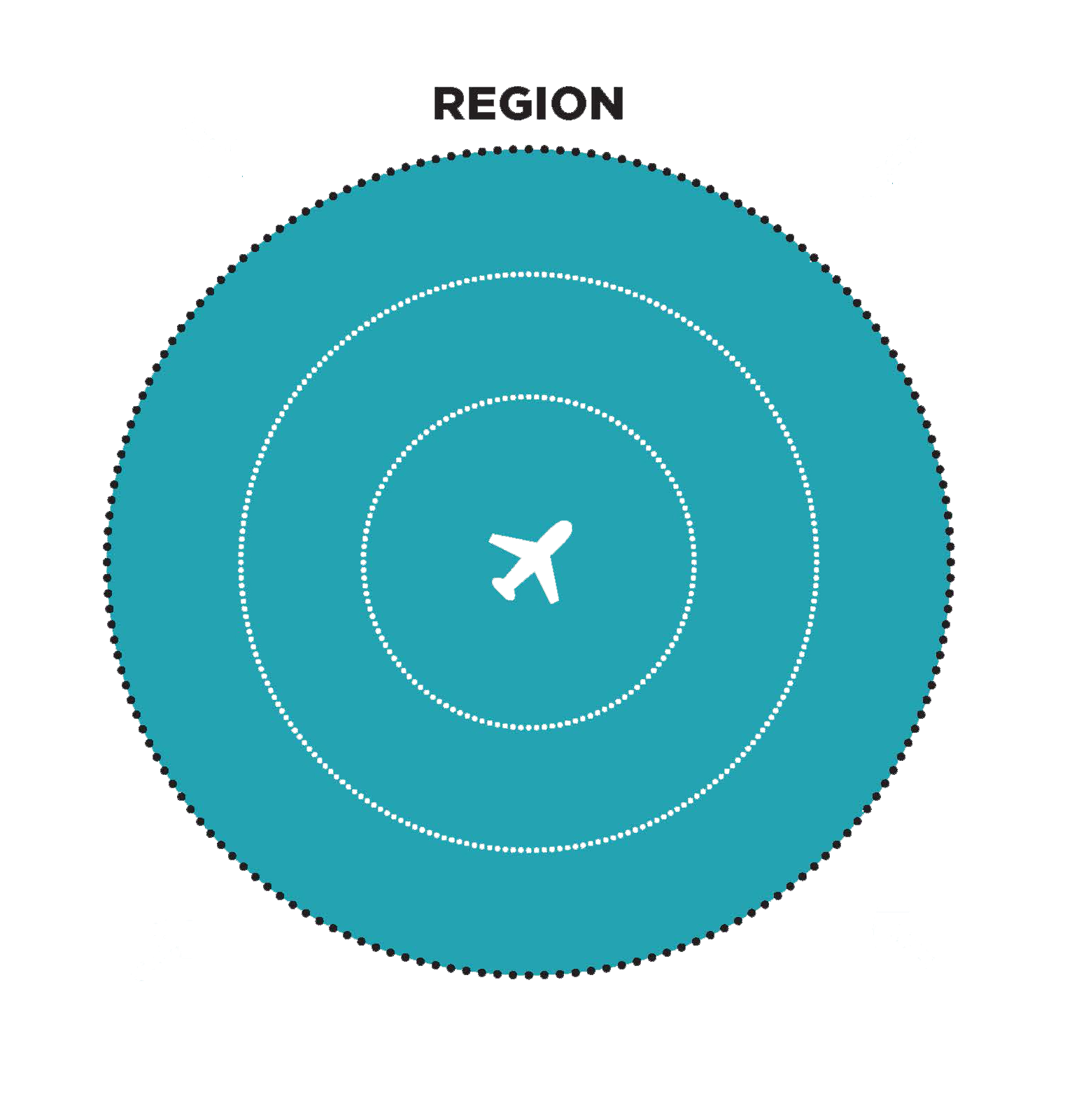
Although the term Impact Areas is new to Blueprint 2.0, the concept builds on three key strategies established during the Incubation Period: Workforce Development, Mobility and Transit, and Redevelopment. These Impact Areas generally align with geographic locations across the Aerotropolis, as illustrated in the accompanying graphic. Through new short- and long-term goals, Blueprint 2.0 provides a clear roadmap for translating these focus areas into actionable steps and implementation.

The Aerotropolis has a strong network of education, training, and industry partners supporting its key economic sectors. However, gaps remain in educational attainment, career readiness, and connections between training opportunities and employer needs, highlighting the need for a more coordinated workforce system.
Strategies
Promote Talent: Strengthen communication and partnerships around the Aerotropolis talent ecosystem, promote local hiring, and better connect employers, residents, and workforce resources.
Align Training with Sectors: Connect education and training programs with priority industries through career mapping, clearly defined pathways, and stronger alignment between employer needs and available programs.
Strengthen Post-Secondary Partnerships: Leverage the Aerotropolis Atlanta Post-Secondary Partnership to coordinate institutions, address workforce gaps, and develop collaborative solutions with employers.
Explore an Aerotropolis Workforce Training Center: Assess the feasibility of a dedicated training center that could consolidate resources, respond to industry demand, and support workforce development across the Aerotropolis.

The Aerotropolis benefits from existing MARTA rail and bus service, but significant gaps remain in connections between transit, employment centers, and surrounding communities. Limited first- and last-mile options, pedestrian and bicycle infrastructure, and east-west connectivity contribute to continued reliance on automobiles.
Strategies
Improve Bus Stop Access: Add sidewalks, crossings, shelters, and other amenities to make existing transit safer and easier to access.
Strengthen First- and Last-Mile Connections: Expand flexible, on-demand mobility options that connect residents and workers to major transit stations and destinations.
Improve East-West Airport Connectivity: Strengthen transit connections across the airport between MARTA stations and major employment centers.
Build a Connected Regional Trail Network: Expand and connect trails, including the Flint River Trail and connections to the Beltline, to improve regional walking and biking access.

The Aerotropolis has significant redevelopment potential, with aging office, retail, industrial, flex, and multifamily properties creating opportunities for adaptive reuse, infill, mixed-use development, and new housing. Strong airport and highway access further support reinvestment and economic growth.
The Blueprint focuses redevelopment along strategic corridors and nodes where underutilized land, transportation, and employment opportunities converge. Catalytic investment in these areas can help diversify the economy while supporting new jobs, housing, services, and amenities.
Strategies
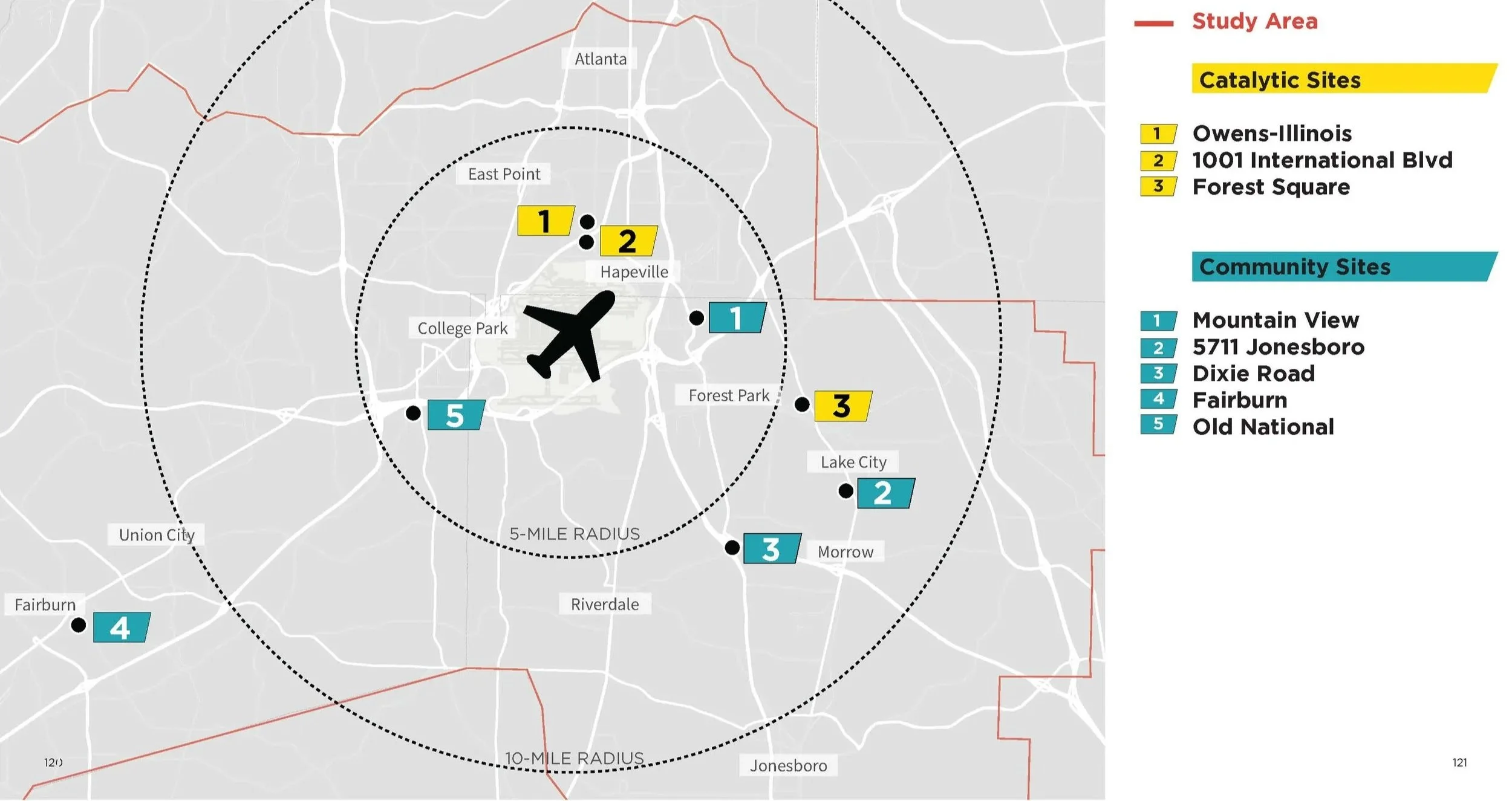
The Blueprint identifies seven catalyst and community sites as priority redevelopment opportunities where targeted investment can generate broader economic and community benefits. Selected based on factors such as site size, redevelopment potential, transportation access, ownership, infrastructure, and surrounding development patterns, the sites are intended to demonstrate opportunities for mixed-use development, employment growth, housing, retail and services, and community amenities, while leveraging the Aerotropolis’ major transportation assets and supporting long-term economic diversification.
Impact Area 3: Redevelopment.
Catalyst and Community Sites.
Blueprint 1.0 identified strategic locations where targeted investment could help stimulate broader economic activity and development across the Aerotropolis. Located along important connections between Hartsfield-Jackson Atlanta International Airport and surrounding communities, these sites benefit from access to transportation infrastructure, employment centers, and other regional assets. Based on stakeholder input and an assessment of existing development patterns, the identified locations offer opportunities to reposition vacant and underutilized properties, support priority industries, and encourage new development. Advancing these opportunities may involve public investment, private development, or partnerships between the two sectors.
Methodology for site selection.
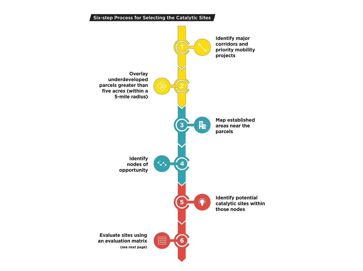
Potential catalytic sites were identified through a six-step process combining GIS analysis and stakeholder input. The analysis focused on sites of five acres or more within a five-mile radius of the airport and their relationship to strategic corridors, transportation networks, employment centers, and key industries.
Identify major corridors and priority mobility projects
Overlay underdeveloped parcels greater than five acres within a 5-mile radius
Map established areas near the parcels
Identify nodes of opportunity
Identify potential catalytic sites within those nodes
Evaluate sites using an evaluation matrix
Explore the Catalyst Sites.
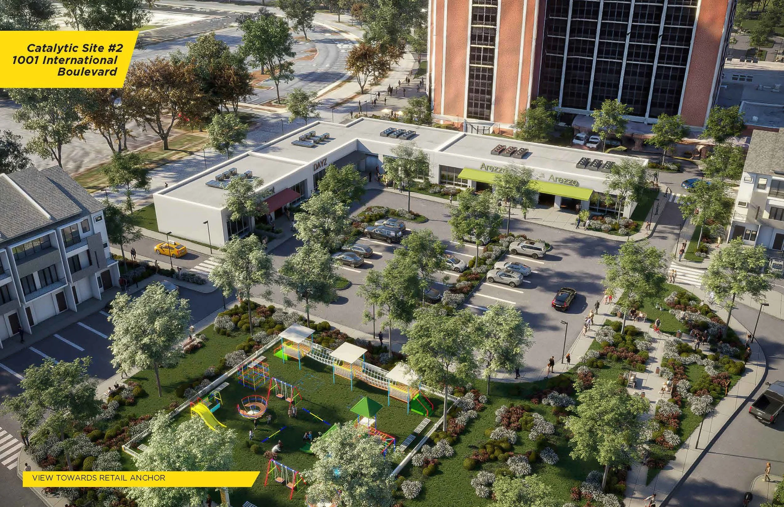
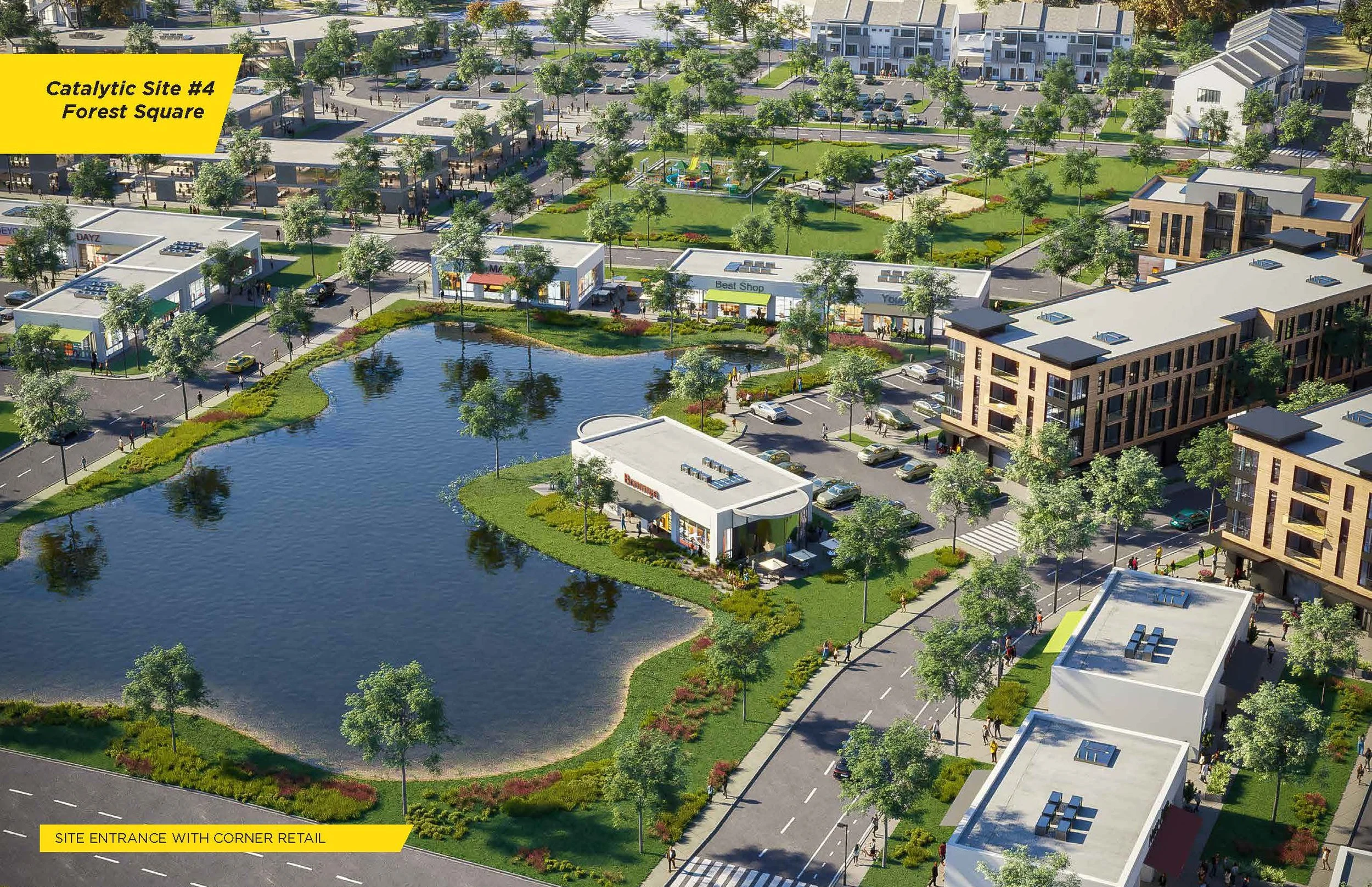
Design and renderings by POND.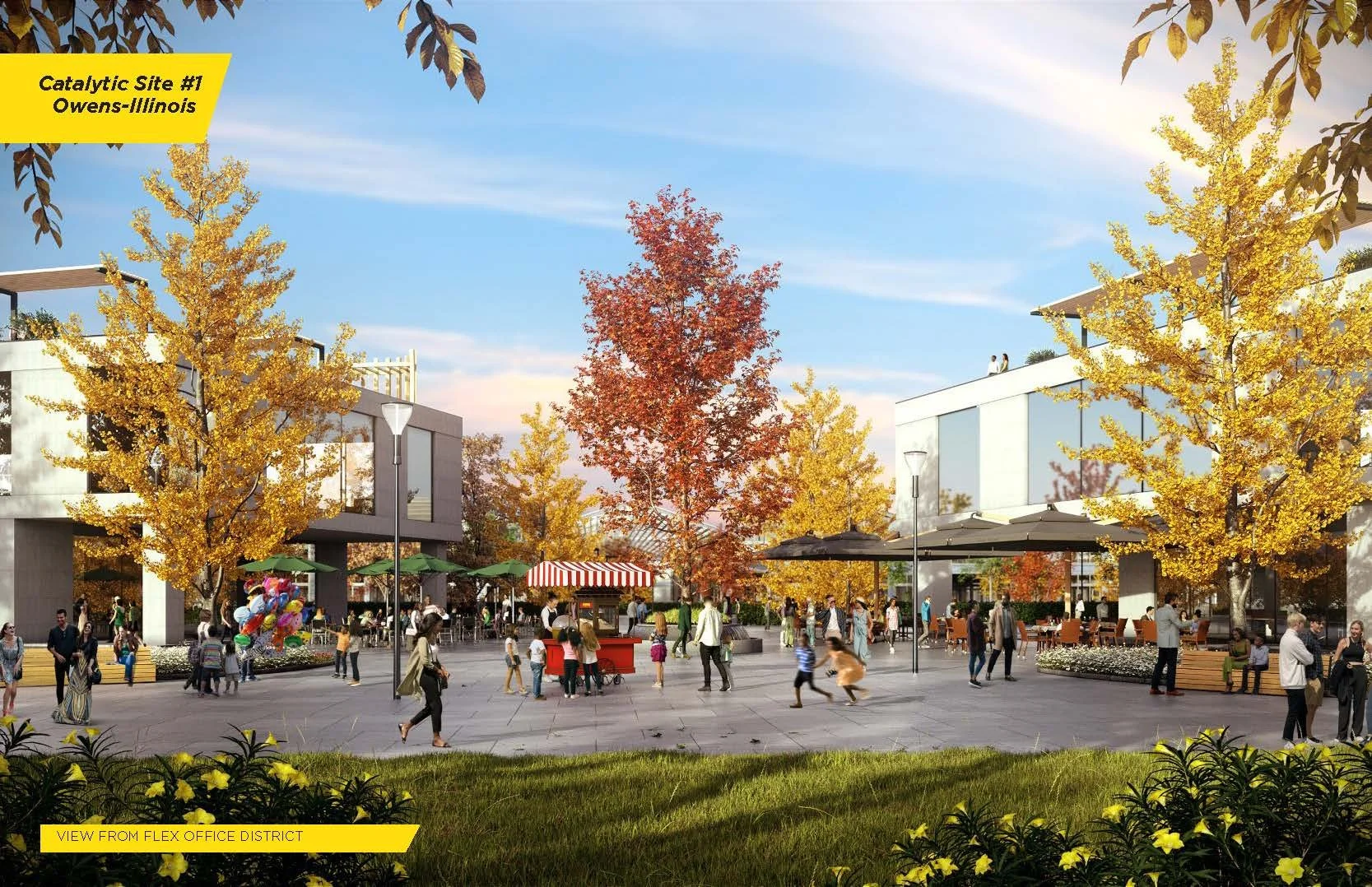
Catalyst Site 1: Owens-Illinois
Catalyst Site 2: 1001 International Boulevard
Catalyst Site 3: Forest Square.
JFG Cities Role: Strategist and branding consultant. Project completed in partnership with POND, MXD, Blue Cypress Consulting, BRS and Hummingbird.
Client: Aerotropolis Atlanta, ATL Airport Community Improvement Districts, ARC, Clayton County, Development Authority of Fulton County, City of Fairburn.
Year: 2024