District 3 Westside Revive
District 3 Westside Revive (D3) was a comprehensive planning effort on the west side of Atlanta, encompassing multiple neighborhoods with distinct identities and needs. The process emphasized neighborhood-scale engagement while maintaining a district-wide perspective.
To support this approach, the district was organized into nine subareas that guided both planning and outreach. Detailed planning focused on Subareas 1 through 5, while Subarea 6 was addressed through the Westside Land Use Framework Plan adopted in November 2017. Additional planning efforts informed Subareas 7 through 9. Overall, the D3 process included thirteen public workshops, numerous stakeholder interviews, and engagement with more than ten thousand residents and participants.

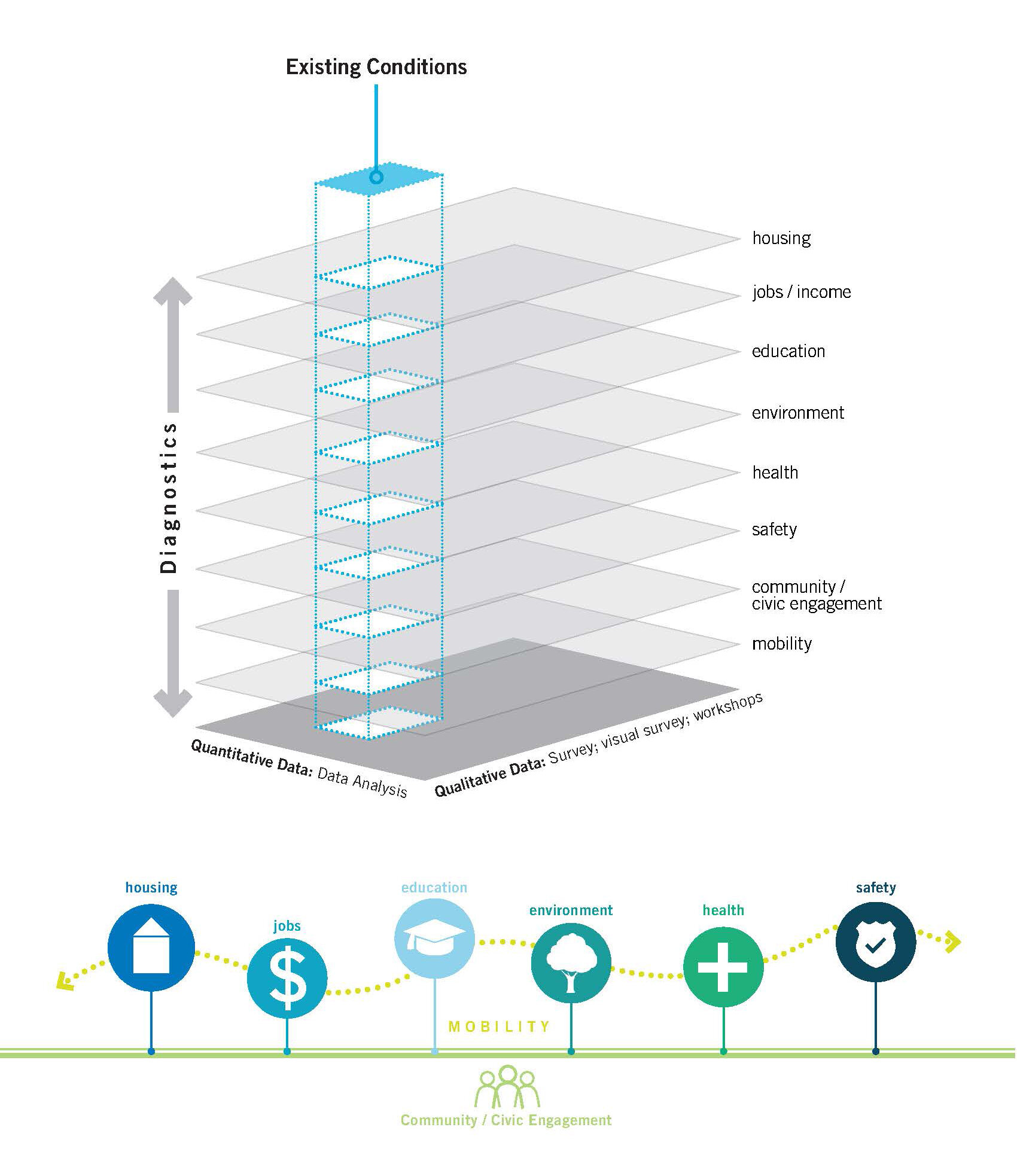
Community engagement centered on a Quality of Life Index organized around seven focus areas: housing, jobs and services, education, environment, health, safety, and community and civic engagement. This framework helped surface both gaps and strengths within each neighborhood, directly informing recommendations related to land use and development, housing, and transportation.
Each subarea was supported by two public workshops. The first focused on gathering local knowledge and understanding neighborhood conditions. The second introduced land use and transportation concepts and invited participants to place images representing different development types on a large-scale map. The resulting feedback and commentary informed the framework plan for each subarea.
The planning team applied a mixed-method approach, combining quantitative and qualitative data across each focus area. This included GIS analysis alongside a comprehensive, geolocated survey administered through an online grid-based platform.
The map example illustrates how three data layers were combined and analyzed at the grid level: proximity to parks calculated through GIS, tree canopy coverage using city open data, and survey responses reflecting resident satisfaction with local parks. This level of analysis was applied consistently across all categories, allowing the team to develop a detailed and nuanced understanding of district conditions.


In addition, each subarea workshop also included opportunities for participants to share their ideas and concerns on a district-wide level. This included a historic timeline and an oversized map of the district where general comments could be posted.

Stakeholder interviews, subarea workshops, and public presentations ultimately came together in a clear, actionable framework for the entire district.
